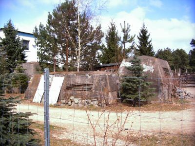
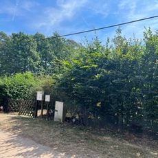
Bunker Kagel, Cold War intelligence bunker in Grünheide, Germany.
Bunker Kagel is an underground facility in Grünheide that served as a listening post during the Cold War. The structure consists of three levels with rooms for radio equipment, switching systems, and administrative areas that were buried below ground.
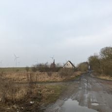
The bunker was planned in the late 1950s and completed in 1961 as East Germany expanded its surveillance network. The structure was built during a time when political tensions between East and West were steadily rising.
The site was part of East Germany's surveillance network and shows how authorities wanted to monitor communications during that era. Visitors can see rooms where people once sat at radio equipment monitoring messages.
Visitors should expect tight underground spaces and limited lighting that reflect the working conditions of that time. Sturdy footwear is recommended since the corridors are uneven and the temperature beneath the ground stays cool.
The bunker was equipped with advanced radio technology that was specifically developed for long range and secure communication. Some of these technical solutions were remarkable for their time and show the technical capacity that existed in such facilities.
Location: Grünheide (Mark)
Part of: Main intelligence center of the Ministry of National Defense
GPS coordinates: 52.47310,13.91400
Latest update: December 14, 2025 09:41
Bundesleistungszentrum Kienbaum
2.8 km
Pyramide Garzau
7.6 km
Löcknitztal
5.3 km
Lange Dammwiesen und Unteres Annatal
6.6 km
Wachtelturm
6.2 km
Torfhaus (Strausberg)
6.9 km
Village church Kagel
1.4 km
Maxseesiedlung
4.9 km
Village church Hennickendorf (Rüdersdorf)
6 km
St.-Anne's church Zinndorf
3.3 km
Church in Garzau
7.1 km
Village church in Werder
5.7 km
Village church Rüdersdorf
6.9 km
Herrensee, Lange-Damm-Wiesen und Barnim-Hänge
7.2 km
Mühle Hennickendorf
6.2 km
Village church Kienbaum
3.5 km
Village Church Herzfelde
4.5 km
Village church Rehfelde
4.5 km
Church in Hoppegarten
7.5 km
Sophienfelde
6.3 km
Herrensee, Lange-Damm-Wiesen und Barnimhänge
7.1 km
Landschaftsschutzgebiet Strausberger Sander-, Os- und Barnimhanglandschaft
6.5 km
Saint Mary of Help Church Herzfelde
4.8 km
Maxsee
5.4 km
Rotes Luch Tiergarten
6.9 km
Löcknitztal
5 km
Naturdenkmal Mehrhundertjähriger Rüster Kienbaum,<br />am Kindergarten in Kienbaum
3.6 km
War memorial Kagel
1.4 kmVisited this place? Tap the stars to rate it and share your experience / photos with the community! Try now! You can cancel it anytime.
Discover hidden gems everywhere you go!
From secret cafés to breathtaking viewpoints, skip the crowded tourist spots and find places that match your style. Our app makes it easy with voice search, smart filtering, route optimization, and insider tips from travelers worldwide. Download now for the complete mobile experience.
A unique approach to discovering new places❞
— Le Figaro
All the places worth exploring❞
— France Info
A tailor-made excursion in just a few clicks❞
— 20 Minutes