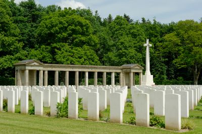
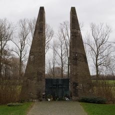
Rheinberg War Cemetery, Commonwealth war cemetery in Rheinberg, Germany.
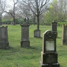
Rheinberg War Cemetery is a large memorial ground with roughly 3,300 white headstones laid out in neat rows across the site. The grounds feature grass areas and flower borders, while forest boundaries create a quiet setting for the memorial.
The cemetery was established in 1946 and brings together Commonwealth servicemen originally from different locations across Germany. During its creation, about 450 graves were transferred here from Cologne as part of post-war consolidation efforts.
The cemetery follows Commonwealth War Graves Commission design standards, creating a space dedicated to remembering servicemen from multiple nations. This shared memorial approach reflects how different countries honored their fallen together after the war.
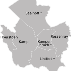
The cemetery is located north of Rheinberg and is reached via exit 7 of the A57 motorway. From the exit, follow the B510 road towards Kamp Lintfort to arrive at the grounds.
The site holds the grave of Victoria Cross recipient Squadron Leader Robert Palmer, one of the few highly decorated officers buried here. Additionally, nine graves of servicemen from other nations are found among the burials, reflecting the international makeup of those commemorated.
Location: Rheinberg
Inception: April 1946
Architects: Philip Hepworth
Accessibility: Wheelchair limited access
Address: Am Englischen Friedhof 44, Rheinberg (Nordrhein-Westfalen), Duitsland
GPS coordinates: 51.52991,6.56333
Latest update: December 14, 2025 11:43
Kamp Abbey
4.5 km
TerraZoo Rheinberg
3.6 km
Halde Pattberg
3.8 km
Stammhaus Underberg
3.2 kmWandelweg
4.5 km
St. Peter
3.3 km
Altes Rathaus (Rheinberg)
3.2 km
Alte Kellnerei
3.4 km
Zollturm
3.6 km
Tor der Toten
3.5 km
Spanischer Vallan
3 km
Kamper Hof
3.1 km
Gelderstraße 22
3.1 km
Evangelische Pfarrkirche Rheinberg
3.2 km
Kamperbruch
3 km
Evangelische Kirche Budberg
5 km
St.-Anna-Kirche
2 km
St.-Anna-Kapelle
2.1 km
Alter Rhein, Jenneckes Gatt, Niepgraben
3.6 km
Forschungsrevier im Orsoyer Rheinbogen
4.3 km
Jüdischer Friedhof
3.2 km
Erlenbruchwald und Landwehr in der Leucht
4.1 km
Leucht
4.8 km
Gemeindezentrum Rheinberg
3.3 km
Landschaftsschutzgebiet Waldgebiete Niersenberg, Hoher Busch, Kamper Berg, Dachsberg, Eyller Berg, südlicher Rayener Berg, Gülixberg
4.3 km
Church of the Assumption, Ossenberg
4.5 km
Abteikirche Kamp
4.5 km
Graf-Luitpold-Straße 6-8
4.8 kmVisited this place? Tap the stars to rate it and share your experience / photos with the community! Try now! You can cancel it anytime.
Discover hidden gems everywhere you go!
From secret cafés to breathtaking viewpoints, skip the crowded tourist spots and find places that match your style. Our app makes it easy with voice search, smart filtering, route optimization, and insider tips from travelers worldwide. Download now for the complete mobile experience.
A unique approach to discovering new places❞
— Le Figaro
All the places worth exploring❞
— France Info
A tailor-made excursion in just a few clicks❞
— 20 Minutes