Enable Location

We need your location to show you interesting places around you

Discover nearby places

Find interesting locations and hidden gems around you

Precise directions

Get accurate directions and distances to places

Your location is never shared with other users. It's only used when you tap the location button.

Teufelsteich

Log in to your account

Start exploring — it's free

Trusted by 62,903 travelers worldwide

Continue with Google
Continue with Apple
or

We will send you a code to connect

By continuing, you accept our Terms and Conditions and our Privacy Policy

Check your inbox

We've sent a pincode in your inbox. Please enter the code below.

Teufelsteich
Discussion Reviews 1 Photos
1.4k Popularity

Teufelsteich, reservoir

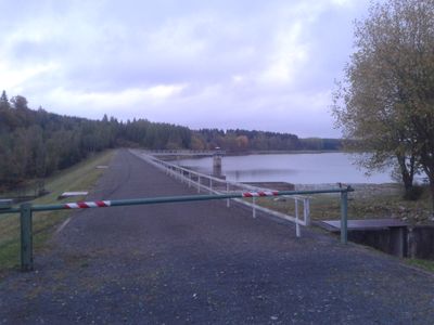
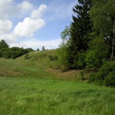
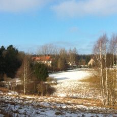
Teufelsteich is a reservoir in the Harz District fed by several small streams that spreads across roughly 20 hectares in an elongated, narrow form. The dam was rebuilt in the 1980s and stands nearly 18 meters high, with the water behind it capable of holding up to 785,000 cubic meters.

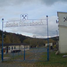
Teufelsteich was built at the end of the 17th century to supply surrounding mines with water and to power machinery through water force. In the 20th century mining declined in importance, and since 1947 the reservoir has primarily served as the region's drinking water supply.

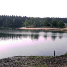
The Teufelsteich takes its name from the nearby Teufelsberg mountain to the northwest, which gave the reservoir its distinctive identity. Today the water serves as a protected drinking water source, which means swimming and water sports are not allowed, though fishing with a permit is permitted.

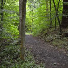
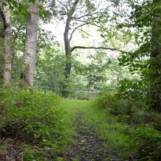
The reservoir can be explored on foot with walking paths around the water and across the dam, including a viewpoint on the southeast shore called Teufelsblick. The area is set in quiet surroundings, well-maintained, and offers leisurely walks, particularly for visitors exploring the region between Harzgerode and Neudorf.

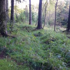
A special spot is the Teufelsblick on the southeast shore, a viewpoint offering fine views of the entire lake that many visitors overlook. The reservoir is also part of the mining heritage trail, a route that tells the story of mining in the region and guides walkers through former mining areas.

The community of curious travelers

AroundUs brings together thousands of curated places, local tips, and hidden gems, enriched daily by 60,000 contributors worldwide.

Start exploring
Location
Elevation above the sea
58 m
Part of
Lower Harz Pond and Ditch System
GPS coordinates
51.62110,11.11890
Latest update
February 9, 2026 07:47
Reviews
Share your experience

No review yet

Discussions
Start a discussion...

No discussion yet

« Teufelsteich - reservoir » is provided by Around Us (aroundus.com). Images and texts are derived from Wikimedia project under a Creative Commons license. You are allowed to copy, distribute, and modify copies of this page, under the conditions set by the license, as long as this note is clearly visible.

Discover hidden gems everywhere you go!

From secret cafés to breathtaking viewpoints, skip the crowded tourist spots and find places that match your style. Our app makes it easy with voice search, smart filtering, route optimization, and insider tips from travelers worldwide. Download now for the complete mobile experience.

Around Us App Screenshot

A unique approach to discovering new places

Le Figaro

All the places worth exploring

France Info

A tailor-made excursion in just a few clicks

20 Minutes

Around Us
Travel Guide & Maps
Download

Send to your phone

QR Code
1

Open the camera app on your mobile.

2

Point at the QR code with your camera. A notification will appear.

3

Tap the notification to open the link.