Hohlestein, Archaeological site and mountain peak in Ahnatal, Germany.
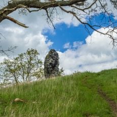
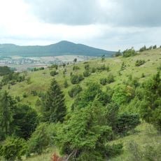
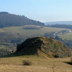
Hohlestein is a 476.6 m basalt outcrop in the Habichtswald nature park between Ahnatal-Weimar and Habichtswald-Dörnberg. The rock measures about 40 m north-south and 30 m east-west, with a near-vertical 25 m wall on its southeast side. Beech trees cover the small summit plateau, where a survey point stands; a shelter hut sits at the southern foot.
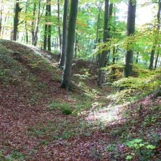
A ring wall of collapsed stone masonry surrounds the foot of the rock; pottery sherds found there date it to the Middle Iron Age. Finds from the 12th or 13th century point to use in the High Middle Ages, and a 1745 report mentions a castle on the site. A square basalt pit on the summit, 2 m by 2 m and 1 m deep, is read as a cistern or well, though some suggest later iron-ore prospecting.
The name Hohlestein refers to the hollowed rock: a square basin about 2 m by 2 m and 1 m deep is cut into the summit plateau and collects rainwater. Below the crag, a ring wall of collapsed stone, dated by pottery sherds to the Middle Iron Age, encircles the foot of the rock.
Access is via the B 251 from Kassel towards Habichtswald, which reaches 393.8 m at a bend by a gravel works at the Dörnberg pass. Leave the car at the Ahnetal inn or at the Triffelsbühl car park just before the pass and continue uphill on foot along the F or M (Märchenlandweg) waymarks. A shelter hut stands at the forest edge below the summit.
The 2 by 2 metre, 1 metre deep square basin cut into the summit basalt is usually read as a cistern for a fort, though some suggest a later iron-ore mining attempt. Rainwater collects in it depending on the season. The rock walls below are now used as a climbing area, and the top can be reached without aids only from the north.
The community of curious travelers
AroundUs brings together thousands of curated places, local tips, and hidden gems, enriched daily by 94,047 contributors worldwide.