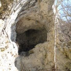
Kolbinger cave, Show cave in Kolbingen, Germany.
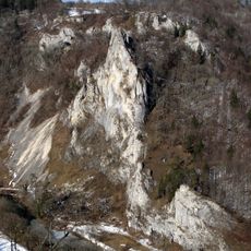
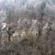
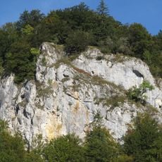
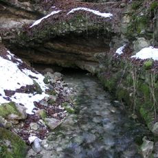
Kolbinger cave is a limestone system that extends about 330 meters through the White Jura rock formations. Natural corridors and chambers alternate throughout, with most passages standing about 4 meters high.
During the 1800s, a thief named Stephan used the cave system as a hiding place, which eventually led to its documentation in an 1879 district description. This early mention established the cave as a known location in the region.
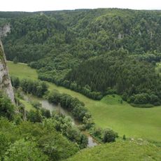
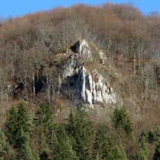
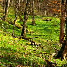
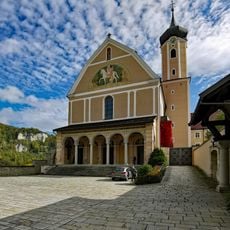
The cave takes its name from the nearby village of Kolbingen and serves today as a place where visitors connect with the underground world beneath the Swabian Jura. Guided tours help people understand the natural formations and the landscape that shaped this region over time.
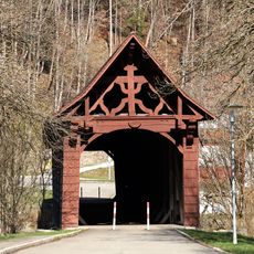
Access to the cave runs from Easter Friday through the last weekend of October, with guided tours covering about 90 meters of the total system. Sturdy shoes and a jacket are recommended, as the underground temperature stays cool year-round.
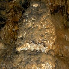
Bright white stalagmites grow inside the cave, including one notable formation that stretches nearly from floor to ceiling within its chamber. These limestone deposits form over many thousands of years and reveal nature's patient work.
Location: Kolbingen
Opening Hours: Saturday 13:00-17:00; Sunday 10:00-17:00; "Karfreitag bis zum letzten Wochenede im Oktober"
Website: http://kolbingen.de/pages/de_kolbinger_höhle.php
GPS coordinates: 48.04040,8.91779
Latest update: December 12, 2025 14:22
Beuron Archabbey
4 km
Schloss Bronnen
3.9 km
Burg Kallenberg
4.2 km
Burgruine Pfannenstiel, Donautal
1.8 km
Ruine Stiegelesfels, Donautal
3.6 km
Mühlheimer Felsenhöhle
1.4 km
Hintelestal
1.2 km
Ruine Kreidenstein, Bäratal
1.6 km
St. Gallus (Mühlheim an der Donau)
1.9 km
Stiegelesfels-Oberes Donautal
3.5 km
Burgstall Stein
3.3 km
Burgreste Lengenfels, Bärenthal
2.6 km
Burgreste Burgstallhöhle
3.5 km
Burgreste Bärenthal
3.3 km
Buchhalde-Oberes Donautal
905 m
Rathaus (Mühlheim an der Donau)
2.7 km
Sebastianskapelle (Mühlheim an der Donau)
2.6 km
Veitskapelle (Mühlheim an der Donau)
1.9 km
Gesamtanlage Altstadt Weil der Stadt
2.5 km
Grabenstraße 11 (Mühlheim an der Donau)
2.9 km
Oberes Tor
2.9 km
Abteikirche Beuron
4 km
Wulfbachquelle
2 km
Mühlheimer Höhle
1.3 km
Beuron Covered Bridge
3.9 km
2 Linden mit Kreuz
3.9 km
Ulme beim Bahnhof
2.8 km
Käppelelinde
3.6 kmVisited this place? Tap the stars to rate it and share your experience / photos with the community! Try now! You can cancel it anytime.
Discover hidden gems everywhere you go!
From secret cafés to breathtaking viewpoints, skip the crowded tourist spots and find places that match your style. Our app makes it easy with voice search, smart filtering, route optimization, and insider tips from travelers worldwide. Download now for the complete mobile experience.
A unique approach to discovering new places❞
— Le Figaro
All the places worth exploring❞
— France Info
A tailor-made excursion in just a few clicks❞
— 20 Minutes