Seilbahn Reiteralpe, Military aerial tramway in Schneizlreuth, Germany
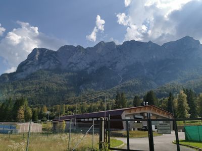
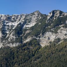
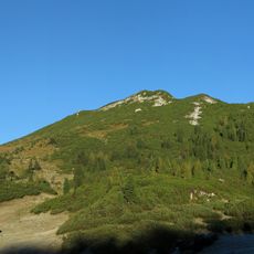
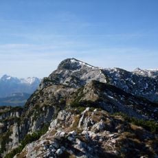
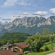
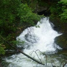
The Seilbahn Reiteralpe is an aerial cable system in the Bavarian Alps connecting Oberjettenberg to the Reiteralpe plateau. The system overcomes an elevation difference of approximately 1000 meters across a distance of 2100 meters with just one support tower.
The system was completed in 1965 and opened up the mountain area for infrastructure and transport. The construction with minimal support structure was an engineering solution for the challenging alpine topography of the region.
The cable system connects two areas within a military installation and is used by soldiers and technical personnel. It enables daily work and training in the mountains where infrastructure would otherwise be difficult to access.
The cabin transports up to 15 people or 2000 kilograms of cargo and can be quickly converted from a passenger version to a freight version. Transportation is adapted to the alpine environment and functions in varying weather conditions.
The main cable span stretches for 1980 meters without an intermediate support, making it one of the longest unsupported spans in Germany. This technical achievement allowed the remote area to be accessed without additional towers.
Location: Schneizlreuth
Length: 2,100 m
Operator: Wehrtechnische Dienststelle für Schutz- und Sondertechnik (WTD 52)
GPS coordinates: 47.66720,12.80320
Latest update: December 8, 2025 21:01
Edelweißlahnerkopf
6 km
Thumseebad
6.1 km
Ristfeuchthorn
3.4 km
Großer Weitschartenkopf
4.1 km
Schloss Oberrain, Unken
6.2 km
Burgstall Amerang
6.2 km
Schottmalhorn
6.3 km
Pfarrkirche hl. Jakobus d.Ä., Unken
6 km
Seewirt (Bad Reichenhall)
5.9 km
Eisberg
5.7 km
Schlegelalm
5.9 km
Antonibergkapelle
4.5 km
Karspitz
6.1 km
Schwarzbachloch
4.6 km
Aschau
2.8 km
Schwarzbach
2.7 km
LSG Thumsee, Stadt Bad Reichenhall und Gemeinde Schneizlreuth
5.7 km
LSG Oberes Saalachtal mit Wendelberg und Kienberg, Gemeinde Schneizlreuth
1.3 km
LSG Lattengebirge
5.6 km
LSG Taubensee, Gemeinde Ramsau bei Berchtesgaden
6.1 km
NSG 'Aschau', NSG 'Schwarzbach' und Schwimmendes Moos
1.8 km
Ehemalige Villa Pachmayr, jetzt Gasthaus Seewirt am Thumsee
5.9 km
Freiheitskämpferdenkmal, Unken
5.9 km
Kugelbachalm
4.2 km
Prünzlkopf
6.3 km
Kramerwirt, Unken
5.8 km
Grenzstein
3.7 km
Obelisk
4.5 kmVisited this place? Tap the stars to rate it and share your experience / photos with the community! Try now! You can cancel it anytime.
Discover hidden gems everywhere you go!
From secret cafés to breathtaking viewpoints, skip the crowded tourist spots and find places that match your style. Our app makes it easy with voice search, smart filtering, route optimization, and insider tips from travelers worldwide. Download now for the complete mobile experience.
A unique approach to discovering new places❞
— Le Figaro
All the places worth exploring❞
— France Info
A tailor-made excursion in just a few clicks❞
— 20 Minutes