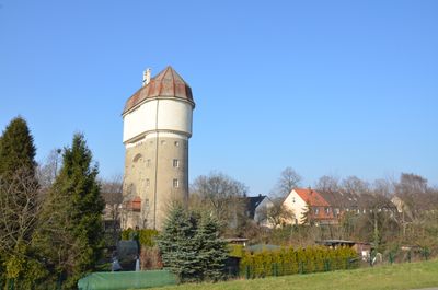
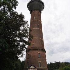
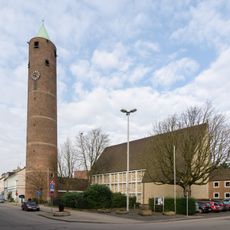
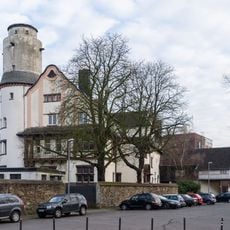
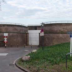
Wasserturm Hohenbudberg, Water tower in Hohenbudberg district, Duisburg, Germany.
Wasserturm Hohenbudberg is an industrial water storage and distribution structure in Duisburg's Hohenbudberg district that served the expanding city. The building displays typical late 19th-century industrial architecture with solid masonry construction and a functional cylindrical design.
The tower was built in the late 1800s when the Ruhr region was rapidly industrializing and needed growing amounts of water for factories and homes. It became part of a broader infrastructure system that supported Duisburg's development as an industrial center.
The tower marks how water supply shaped urban growth in the industrial era and remains visible in the neighborhood's layout today. Walking around it, you can sense how essential infrastructure like this enabled communities to expand and thrive.
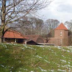
The structure is accessible as part of walking routes through the industrial area and can be viewed from the outside. It works well as a stop on a walk through the Ruhr Valley, where several similar buildings stand nearby for comparison.
The tower is part of a network of more than 90 structures that document water management history across the Ruhr region. This network spans multiple rivers and shows how water systems were planned and operated on a regional scale.
The community of curious travelers
AroundUs brings together thousands of curated places, local tips, and hidden gems, enriched daily by 60,000 contributors worldwide.