Heubatspitze, Mountain summit in Swabia, Germany.
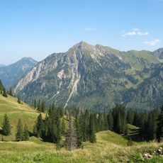
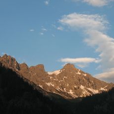
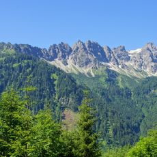
Heubatspitze is a 2,008-metre secondary summit of the Rotspitz in the Allgäu Alps, in the Daumengruppe ridge that runs from the Breitenberg over the Hohen Gänge to the Kleiner Daumen. A slightly notched ridge (1,950 m) connects it westward to the Rotspitz, and the Haseneckscharte (1,895 m) lies between it and the Kleiner Daumen. Its south flank holds the hay meadows, called Hoibaten in dialect, that give the mountain its name.
The name appears in writing as early as 1774, when Peter Anich's Atlas Tyrolensis marked an "Elb Spiz" here, probably named after the Alpe Elpen whose pasture lies northeast below the summit. The present name comes from the south-flank hay meadows, called Hoibaten in local dialect.
The name comes from the Heuplätze (hay meadows) on the south flank, called Hoibaten in the local dialect. An earlier name, Elb Spiz, recorded in Peter Anich's Atlas Tyrolensis of 1774, probably refers to the Alpe Elpen, whose pasture lies northeast below the summit.
Access to the summit requires proper alpine equipment including helmet and harness for the rope-secured sections, with the main route starting from parking areas near Bad Hindelang and spanning approximately 16 kilometers total distance.
The name comes from the Hoibaten, the hay meadows on the south flank, while a 1774 map by Peter Anich labels the peak Elb Spiz, probably after the Alpe Elpen pasture below it. The route from the Breitenberg over the Hohen Gänge is secured with wire rope and an iron ladder and demands sure footing, a head for heights and climbing ability of grade I.
The community of curious travelers
AroundUs brings together thousands of curated places, local tips, and hidden gems, enriched daily by 93,750 contributors worldwide.