Cemetery Wall of War Gravesite Hadern
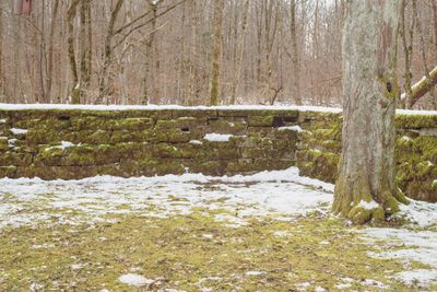
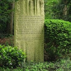
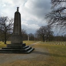
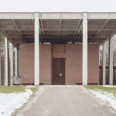
Cemetery Wall of War Gravesite Hadern, Cemetery wall and memorial site in Großhadern, Munich, Germany.
Description
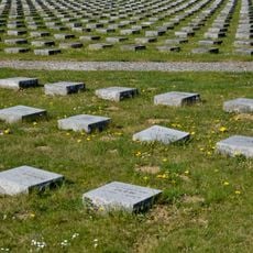
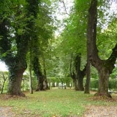
The Cemetery Wall of War Gravesite Hadern is a long memorial structure that marks the burial areas for the fallen around a commemorative site in Munich. The complex features different sections for graves and is laid out to allow visitors to move easily between areas.
History
The wall was built in 1965 as a place to remember soldiers who died in different conflicts. It was created when Munich was rebuilding and establishing new memorial sites to honor the fallen.
Culture
The wall shapes a space where visitors walk slowly and read names carved in stone, marking a place set aside for remembrance. This reflects how people in the region honor those who died and keep their memory alive.
Practical
The site sits near Tischlerstraße and is accessible on foot with pathways throughout the grounds. Visitors should allow time to walk quietly through and read the inscriptions at their own pace.
Did you know?
The wall is registered in Bavaria's monument records with identification number D-1-62-000-7948, marking its official recognition as a historic structure. This registration ensures the site is systematically maintained and protected as part of documented heritage.
AroundUs brings together thousands of curated places, local tips, and hidden gems, enriched daily by 60,000 contributors worldwide. Discover all places nearby (Munich).
Munich Forest Cemetery
1.3 km
Fürstenried Palace
754 m
Christoph München
1.6 km
Memorial to the victims of National Socialist euthanasia crimes
1.4 km
St. Canisius
1.7 km
St. Matthias
937 m
St. Peter's Church
1.7 km
St. Karl Borromäus
1.1 km
St. Nikolaus
1.3 km
Waldfriedhofstraße
1.3 km
St. Nikolaus (Neuried bei München)
1.3 km
Fürstenried Palace
782 m
Pestsäule Fürstenried
948 m
Rathaus Neuried
1.1 km
Ehemaliges Bauernhaus und Tafernwirtschaft, sogenannt Beim Wirtsbauer
1.4 km
Waldfriedhof Forst-Kasten-Allee 4 in München
1.6 km
Villa
1.6 km
Waldfriedhof, Gebiet nördl. des Schlosses Fürstenried einschl. Schloß und Schloßpark, Geländestreifen entlang der Allee zwischen Kreuzhof und Fürstenried, Waldgebiet südl. Albert-Roßhaupter-Str. (Sendlinger Wald), Allee der Albert-Roßhaupter-Str
1.5 km
Villa
1.7 km
Pelargonienweg 8
1.7 km
Italian military cemetery
788 m
Leichenhalle Zöllerstraße 21 in München
645 m
Malerische Villa
1.6 km
Ehem. Bauern- und Wirtshaus
1.6 km
Bauernanwesen
1.6 km
Canisiusschule Hadern
1.7 km
Ehemaliges Bauernhaus und Schmiede, sogenannt Beim Schmied
1.3 km
Handwerkerhaus
1.2 kmDiscover hidden gems everywhere you go!
From secret cafés to breathtaking viewpoints, skip the crowded tourist spots and find places that match your style. Our app makes it easy with voice search, smart filtering, route optimization, and insider tips from travelers worldwide. Download now for the complete mobile experience.
A unique approach to discovering new places❞
— Le Figaro
All the places worth exploring❞
— France Info
A tailor-made excursion in just a few clicks❞
— 20 Minutes