Enable Location

We need your location to show you interesting places around you

Discover nearby places

Find interesting locations and hidden gems around you

Precise directions

Get accurate directions and distances to places

Your location is never shared with other users. It's only used when you tap the location button.

Antony

Log in to your account

Start exploring — it's free

Trusted by 61,688 travelers worldwide

Continue with Google
Continue with Apple
or

We will send you a code to connect

By continuing, you accept our Terms and Conditions and our Privacy Policy

Check your inbox

We've sent a pincode in your inbox. Please enter the code below.

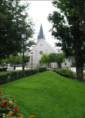
Antony, Administrative commune in southwestern Paris suburbs, France

Description

Antony is a commune in the southwestern suburbs of Paris and covers an area of around ten square kilometers. The town lies in the Hauts-de-Seine department and forms part of the Grand Paris metropolitan area, connected to the city center by the RER B railway line.

History

The settlement began during the Gallo-Roman period in the third century and first appeared in written records in 829 under King Louis the Pious. Over the centuries, it grew from a rural village into a suburban town that now belongs to the Paris metropolitan region.

Culture

Residents use the six railway stations daily to commute between their homes and the capital in less than half an hour. This connection shapes the rhythm of everyday life and makes the town a place that balances quiet suburban living with proximity to the city.

Practical

The town offers digital services through a mobile app, allowing residents to access administrative procedures and community updates. Visitors will find the area well connected to the railway network, making short travel times to the capital possible.

Did you know?

The town maintains precise demographic records and documents 746 residents aged ninety or older. This level of detail shows how closely the administration tracks and analyzes the population structure.

Location
Location
Elevation above the sea
66 m
Shares border with
Bourg-la-Reine, L'Haÿ-les-Roses, Fresnes, Wissous, Massy, Verrières-le-Buisson, Châtenay-Malabry, Sceaux
Phone
GPS coordinates
48.75333,2.29667
Latest update
December 13, 2025 16:30

AroundUs brings together thousands of curated places, local tips, and hidden gems, enriched daily by 60,000 contributors worldwide. Discover all places nearby (Hauts-de-Seine).

« Antony - Administrative commune in southwestern Paris suburbs, France » is provided by Around Us (aroundus.com). Images and texts are derived from Wikimedia project under a Creative Commons license. You are allowed to copy, distribute, and modify copies of this page, under the conditions set by the license, as long as this note is clearly visible.

Discover hidden gems everywhere you go!

From secret cafés to breathtaking viewpoints, skip the crowded tourist spots and find places that match your style. Our app makes it easy with voice search, smart filtering, route optimization, and insider tips from travelers worldwide. Download now for the complete mobile experience.

Around Us App Screenshot

A unique approach to discovering new places

Le Figaro

All the places worth exploring

France Info

A tailor-made excursion in just a few clicks

20 Minutes

Around Us
Travel Guide & Maps
Download

Send to your phone

QR Code
1

Open the camera app on your mobile.

2

Point at the QR code with your camera. A notification will appear.

3

Tap the notification to open the link.