Pic de les Salines, Mountain summit in Eastern Pyrenees, France and Spain
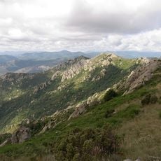
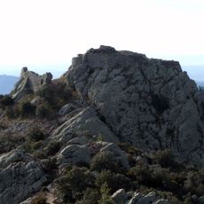
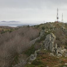
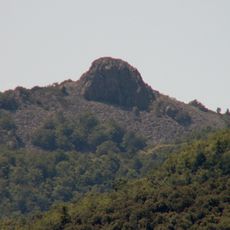
Pic de les Salines, also called puig de les Pedrisses in Catalan, is a pale gray rocky summit in the Eastern Pyrenees reaching 1,333 m. Its broad, uneven ridge has a rounded peak on the left and a lower crest running right. The summit is shared by Maçanet de Cabrenys and Céret, with Maureillas-las-Illas on the French slope.
The sources record no medieval salt trade or commercial role for the summit. The name comes from the Catalan 'les salines', a place where salt was left for livestock, and the peak's other Catalan name, puig de les Pedrisses, refers to a pedrissa, a quarry. The summit is shared only by Maçanet de Cabrenys and Ceret, and a geodesic vertex (reference 303076002) stands on top.
The Catalan name "les Salines" refers to a spot where salt was left out for livestock, while the Catalan name puig de les Pedrisses comes from pedrissa, a quarry. In Catalan, puig originally meant a rounded summit, though pic has often replaced it. The peak is called puig de les Pedrisses in the Alt Empordà and pic de les Salines in the Vallespir.
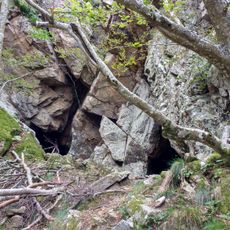
The summit is a waypoint on walking and mountain-bike routes through this part of the Pyrenees, and the ridge can be reached on foot from both Maçanet de Cabrenys and Céret. A geodesic vertex marker (reference 303076002) stands at the top. On the northern slope lies the Cova dels Trabucaires, a cave to look for on the way up.
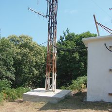
The summit carries a geodetic vertex, reference 303076002, and antennas on top broadcast the South Catalan radio stations received in Roussillon. On the northern slope lies the Cova dels Trabucaires, a cave whose name recalls the trabucaires, armed men of the 19th-century Carlist conflicts.
The community of curious travelers
AroundUs brings together thousands of curated places, local tips, and hidden gems, enriched daily by 94,658 contributors worldwide.