Mont-Louis

Log in to your account

AroundUs is a community-driven map of interesting places, built by curious explorers like you. It grows with every review, story, and photo you share.
Connect to save your favorite spots, contribute locations, and create personalized routes.
By continuing, you accept our Terms and Conditions and our Privacy Policy
Add to collection
Map
Suggest a change
Share

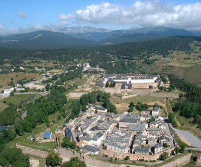
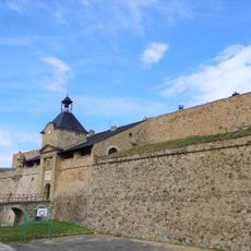
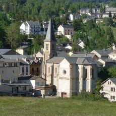
Mont-Louis, Military citadel at 1600 meters elevation in Pyrénées-Orientales, France.

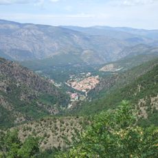
Mont-Louis is a military fortress built on a high plateau in the Pyrénées-Orientales, sitting at about 1600 meters (5250 feet) elevation. The site features thick stone ramparts and angular bastions arranged to defend against attack from multiple directions.

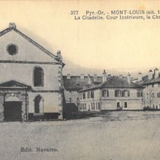
The fortress was founded in 1679 after the Kingdom of France took control of the Roussillon region. Its construction served to defend the newly established French border against Spain.

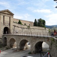
The fortress carries the name of King Louis XIV, who ordered its construction to mark French control over the newly acquired territory. Walking through the streets today, you can see how residents and visitors move through the old military layout, with narrow passages and open squares that reflect its defensive design.

The fortress sits in the mountains, so warm clothing and sturdy shoes are important, especially because weather conditions can change quickly. The site is open for visitors to walk around and explore the old ramparts and fortification structures.

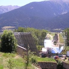
The site houses an experimental solar furnace built in 1949, making it one of the first of its kind in the world. This facility remains in use today for solar energy research, revealing a fascinating side to the fortress beyond its military past.

Location: Pyrénées-Orientales

Location: arrondissement of Prades

Location: Conflent

Elevation above the sea: 1,577 m

Shares border with: La Llagonne, Sauto, La Cabanasse

Address: 66210 Mont-Louis, France

Phone: +33468042118

Email: montlouis66.mairie@gmail.com

Website: https://mont-louis.net

GPS coordinates: 42.50806,2.12278

Latest update: December 6, 2025 16:01

Photos
Natural and historical sites in Eastern Pyrenees France

The Eastern Pyrenees in France show the meeting of mountains and Mediterranean coasts. The region stretches from high peaks like Canigou to seaside towns with centuries-old fortifications. Medieval castles, historic railways, gorges, and thermal springs dot the landscape, while nature reserves...

Reviews

Visited this place? Tap the stars to rate it and share your experience / photos with the community! Try now! You can cancel it anytime.

« Mont-Louis - Military citadel at 1600 meters elevation in Pyrénées-Orientales, France » is provided by Around Us (aroundus.com). Images and texts are derived from Wikimedia project under a Creative Commons license. You are allowed to copy, distribute, and modify copies of this page, under the conditions set by the license, as long as this note is clearly visible.

Discover hidden gems everywhere you go!

From secret cafés to breathtaking viewpoints, skip the crowded tourist spots and find places that match your style. Our app makes it easy with voice search, smart filtering, route optimization, and insider tips from travelers worldwide. Download now for the complete mobile experience.

Around Us App Screenshot

A unique approach to discovering new places

Le Figaro

All the places worth exploring

France Info

A tailor-made excursion in just a few clicks

20 Minutes