Enable Location

We need your location to show you interesting places around you

Discover nearby places

Find interesting locations and hidden gems around you

Precise directions

Get accurate directions and distances to places

Your location is never shared with other users. It's only used when you tap the location button.

Ille-sur-Têt

Log in to your account

Start exploring — it's free

Trusted by 61,919 travelers worldwide

Continue with Google
Continue with Apple
or

We will send you a code to connect

By continuing, you accept our Terms and Conditions and our Privacy Policy

Check your inbox

We've sent a pincode in your inbox. Please enter the code below.

Ille-sur-Têt, Commune in Pyrénées-Orientales, France

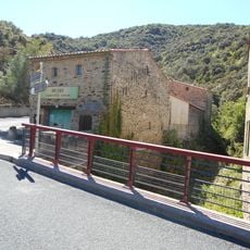
Ille-sur-Têt is a commune in the eastern foothills of the Pyrenees, spreading along route nationale 116 in the Ribéral region. The village extends across about 3,100 hectares with elevations ranging between 110 and 450 meters.

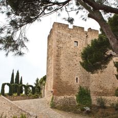
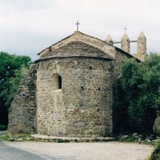
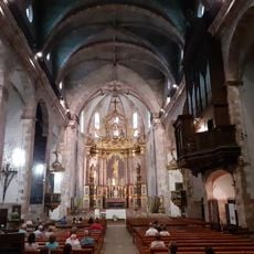
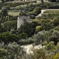
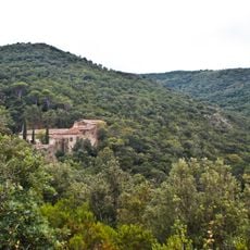
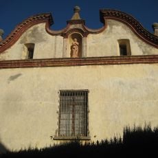
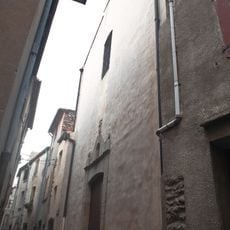
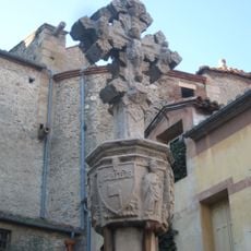
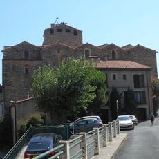
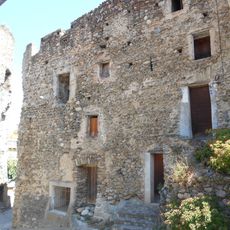
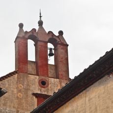
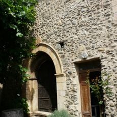
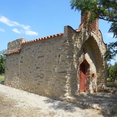
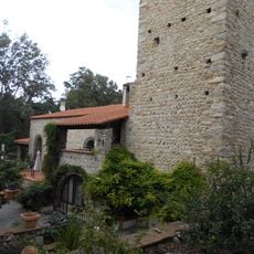
The commune is home to two churches from different periods: Sainte-Marie de la Rodona from the 12th century and Saint-Étienne from the 17th century. These buildings reflect the religious continuity and architectural changes across the centuries.

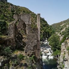
Writer Prosper Mérimée drew inspiration from this place for his novella "La Vénus d'Ille," using local elements and the region's character in his storytelling. The town carries this literary connection as part of its identity.

The commune is easily accessible via route nationale 116 and offers various services to visitors and residents. The France services office on Rue de Bourdeville assists with administrative matters including family allowances, healthcare, retirement, and employment documentation.

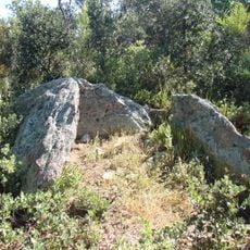
Les Orgues displays natural chimney-like rock formations carved from Pliocene sediments near the Têt River, creating unusual geological structures. These distinctive formations offer a rare window into the region's geological past.

The community of curious travelers

AroundUs brings together thousands of curated places, local tips, and hidden gems, enriched daily by 60,000 contributors worldwide.

Start exploring
Location
Location
Elevation above the sea
203 m
Shares border with
Bélesta, Néfiach, Millas, Corbère, Saint-Michel-de-Llotes, Bouleternère, Rodès, Montalba-le-Château
Address
66130 Ille-sur-Têt, France
Phone
GPS coordinates
42.67056,2.62056
Latest update
December 22, 2025 16:33
« Ille-sur-Têt - Commune in Pyrénées-Orientales, France » is provided by Around Us (aroundus.com). Images and texts are derived from Wikimedia project under a Creative Commons license. You are allowed to copy, distribute, and modify copies of this page, under the conditions set by the license, as long as this note is clearly visible.

Discover hidden gems everywhere you go!

From secret cafés to breathtaking viewpoints, skip the crowded tourist spots and find places that match your style. Our app makes it easy with voice search, smart filtering, route optimization, and insider tips from travelers worldwide. Download now for the complete mobile experience.

Around Us App Screenshot

A unique approach to discovering new places

Le Figaro

All the places worth exploring

France Info

A tailor-made excursion in just a few clicks

20 Minutes

Around Us
Travel Guide & Maps
Download

Send to your phone

QR Code
1

Open the camera app on your mobile.

2

Point at the QR code with your camera. A notification will appear.

3

Tap the notification to open the link.