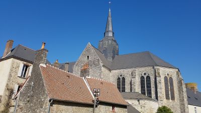
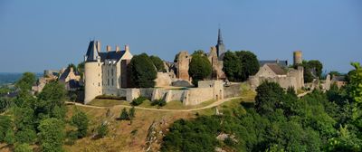
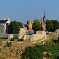
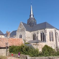
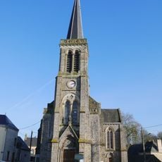
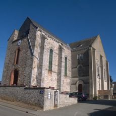
Sainte-Suzanne, Medieval fortified commune in Mayenne, France.
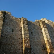
Sainte-Suzanne is a fortified settlement perched on a rocky promontory above the Erve River valley, encircled by stone ramparts with watchtowers marking the corners. The settlement spreads across this elevated location with medieval defensive structures that remain visible and intact.
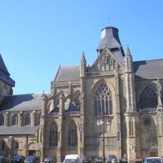
The settlement was established as a fortress and served as a key defensive point during medieval conflicts in the region. Its elevated position and fortifications made it strategically important for controlling the valley below.
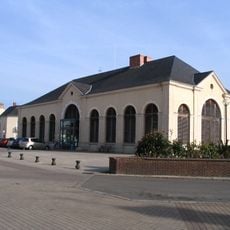
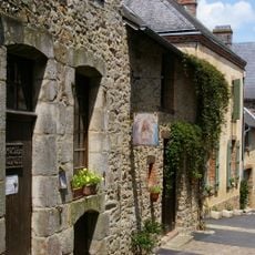
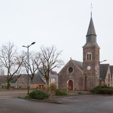
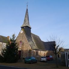
The village displays regional architecture with granite houses and slate roofs arranged along narrow medieval streets within the walls. Local residents move through these tight passages daily, and the stone construction shapes the entire character of the settlement.
The location is best explored on foot, with the narrow streets requiring a leisurely pace to enjoy the setting. Visitors should wear sturdy shoes as the paths are cobbled and sometimes steep.
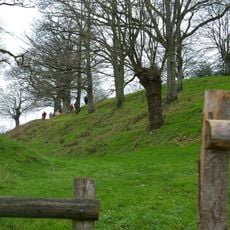
The settlement is less populated today than in its past, which allows the structure of medieval life to remain clearly visible in the streets and buildings. This quietness enables visitors to sense the layout and patterns of earlier times directly.
Location: Mayenne
Location: Sainte-Suzanne-et-Chammes
Location: arrondissement of Laval
Elevation above the sea: 117 m
Shares border with: Évron, Voutré, Torcé-Viviers-en-Charnie, Blandouet, Chammes, Châtres-la-Forêt
Address: Sainte-Suzanne, 53270 Sainte-Suzanne-et-Chammes, France
Website: https://ste-suzanne.fr
GPS coordinates: 48.09750,-0.35306
Latest update: December 6, 2025 16:02
Château de Sainte-Suzanne
342 m
Evron Abbey
7.6 km
Château de Montecler
6.6 km
Halles-mairie d'Évron
7.2 km
Donjon de Sainte-Suzanne
140 m
Camp de Beugy
140 m
Les Erves dolmen
2.7 km
Église Sainte-Suzanne de Sainte-Suzanne
269 m
Musée de l'Auditoire
289 m
Remparts de Sainte-Suzanne
444 m
Table des Diables
3.9 km
Chapelle Saint-Crépin
7.5 km
Dolmen des Îles
3 km
Église Saint-Pierre de Torcé
6.8 km
Jardin Aquatique
7.7 km
Moulin à papier de Sainte-Suzanne-et-Chammes
555 m
Église Saint-Martin de Châtres-la-Forêt
7 km
Basilique Notre-Dame de l'Épine
7.5 km
Église Saint-Martin de Livet
8.1 km
Église Saint-Louis de Blandouet
5.4 km
Église Saint-Thuribe d'Assé-le-Bérenger
6.9 km
Chapelle des Trois-Poiriers
6 km
Église Saint-Pierre de Voutré
6.4 km
Église Saint-Pierre de Chammes
3.2 km
Église Saint-Léger de Saint-Léger
7.8 km
Chapelle Saint-Nicolas de la ferme de Saint-Nicolas
4.9 km
Basilique Notre-Dame de l'Épine d'Évron
7.5 km
Chapelle Sainte-Madeleine de Sainte-Suzanne
332 mVisited this place? Tap the stars to rate it and share your experience / photos with the community! Try now! You can cancel it anytime.
Discover hidden gems everywhere you go!
From secret cafés to breathtaking viewpoints, skip the crowded tourist spots and find places that match your style. Our app makes it easy with voice search, smart filtering, route optimization, and insider tips from travelers worldwide. Download now for the complete mobile experience.
A unique approach to discovering new places❞
— Le Figaro
All the places worth exploring❞
— France Info
A tailor-made excursion in just a few clicks❞
— 20 Minutes