La Rochette, commune in Ardèche, France
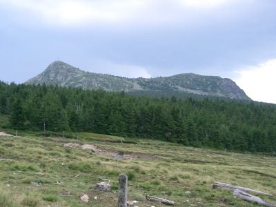
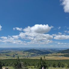
La Rochette is a volcanic mountain in the Ardèche region of France, rising prominently above the surrounding landscape. The summit features steep slopes and grasslands crossed by marked hiking paths.
The mountain formed from volcanic activity millions of years ago, bearing traces of ancient geological processes. Its location marked boundaries between historic regions in central France.
The name refers to a small rock outcrop, reflecting local connection to the mountain landscape. Residents have long adapted to highland life, using the slopes for grazing livestock.
Several marked trails lead to the summit and suit different fitness levels. Trail conditions vary by season, so appropriate footwear and gear make the hike safer and more enjoyable.
The site serves as a launch point for paragliders and hang gliders who take advantage of rising air currents. This aerial sport activity draws enthusiasts from beyond the region.
The community of curious travelers
AroundUs brings together thousands of curated places, local tips, and hidden gems, enriched daily by 60,000 contributors worldwide.