Enable Location

We need your location to show you interesting places around you

Discover nearby places

Find interesting locations and hidden gems around you

Precise directions

Get accurate directions and distances to places

Your location is never shared with other users. It's only used when you tap the location button.

Pont Charles-de-Gaulle

Log in to your account

Start exploring — it's free

Trusted by 63,103 travelers worldwide

Continue with Google
Continue with Apple
or

We will send you a code to connect

By continuing, you accept our Terms and Conditions and our Privacy Policy

Check your inbox

We've sent a pincode in your inbox. Please enter the code below.

Pont Charles-de-Gaulle
Discussion Reviews 3 Photos
7.9k Popularity

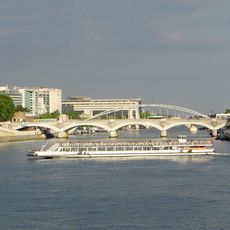
Pont Charles-de-Gaulle, Road bridge between 12th and 13th arrondissements, France

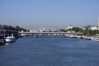
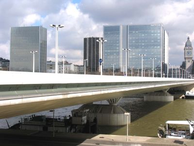
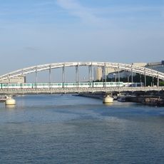
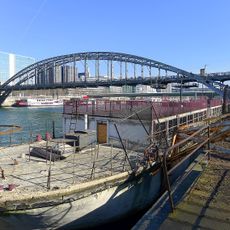
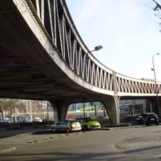
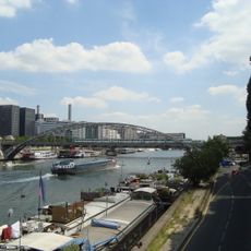
The Pont Charles-de-Gaulle is a road bridge crossing the Seine between the 12th and 13th arrondissements, carrying four traffic lanes on a steel deck. The structure rests on concrete piers topped with conical steel frames that resemble inverted tents supporting the main roadway.

Construction began in 1986 after Paris authorities identified the need to reduce traffic congestion between the Pont de Bercy and Pont d'Austerlitz. The project filled a gap in the eastern river crossings where vehicle flow had become problematic.

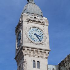
The bridge connects two major railway stations and serves as a daily passage for commuters moving between the eastern districts. It shapes the river landscape and facilitates access to both transportation hubs on either bank.

Walking and cycling are possible on dedicated paths separated from traffic, making the crossing straightforward for non-drivers. The nearby Gare d'Austerlitz metro station provides convenient access to the wider city from either side of the bridge.

The distinctive conical steel frames beneath the bridge do more than support it—they give the structure an unmistakable silhouette among Paris's bridges. This geometric design was chosen to distribute weight efficiently while making the massive construction appear lighter and more refined.

The community of curious travelers

AroundUs brings together thousands of curated places, local tips, and hidden gems, enriched daily by 60,000 contributors worldwide.

Start exploring
Inception
1996
Architects
Louis Arretche
Official opening
1996
Length
207.75 m
Part of
road network of Paris
Shares border with
quai d'Austerlitz, avenue Pierre-Mendès-France, quai de la Rapée, rue Van-Gogh
GPS coordinates
48.84250,2.36889
Latest update
December 8, 2025 20:00
Reviews
Share your experience

No review yet

Discussions
Start a discussion...

No discussion yet

« Pont Charles-de-Gaulle - Road bridge between 12th and 13th arrondissements, France » is provided by Around Us (aroundus.com). Images and texts are derived from Wikimedia project under a Creative Commons license. You are allowed to copy, distribute, and modify copies of this page, under the conditions set by the license, as long as this note is clearly visible.

Discover hidden gems everywhere you go!

From secret cafés to breathtaking viewpoints, skip the crowded tourist spots and find places that match your style. Our app makes it easy with voice search, smart filtering, route optimization, and insider tips from travelers worldwide. Download now for the complete mobile experience.

Around Us App Screenshot

A unique approach to discovering new places

Le Figaro

All the places worth exploring

France Info

A tailor-made excursion in just a few clicks

20 Minutes

Around Us
Travel Guide & Maps
Download

Send to your phone

QR Code
1

Open the camera app on your mobile.

2

Point at the QR code with your camera. A notification will appear.

3

Tap the notification to open the link.