Enable Location

We need your location to show you interesting places around you

Discover nearby places

Find interesting locations and hidden gems around you

Precise directions

Get accurate directions and distances to places

Your location is never shared with other users. It's only used when you tap the location button.

Log in to your account

Start exploring — it's free

Trusted by 61,963 travelers worldwide

Continue with Google
Continue with Apple
or

We will send you a code to connect

By continuing, you accept our Terms and Conditions and our Privacy Policy

Check your inbox

We've sent a pincode in your inbox. Please enter the code below.

Uxellodunum

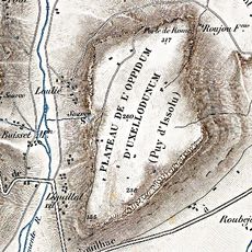
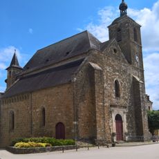
Uxellodunum, Iron Age oppidum in Lot, France

Uxellodunum is an ancient fortified settlement on a hillside above the Dordogne River in Lot, featuring steep cliffs and natural defensive positions. The site spreads across multiple terraced levels, revealing the sophisticated layout of a Celtic fortress.

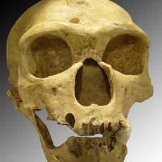
The settlement became the site of Julius Caesar's final siege in 51 BCE, ending the Gallic Wars and Celtic resistance. This decisive moment led to Roman control over Gaul and marked a turning point in ancient European history.

The site shows how the Cadurci people organized their settlement with practical fortifications and water systems. Walking through the remains, you can see the way they adapted their buildings to the hillside terrain.

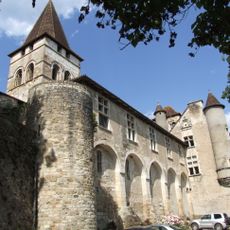
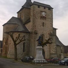
The site is accessible via walking paths across the hillside, with information panels explaining the siege and settlement history. Guided tours are offered at the nearby museum in Martel, which provides context and additional insights into the excavations.

The Romans devised a clever siege strategy by digging tunnels to cut off the Gauls' hidden water source on the hilltop. This engineering technique proved decisive and was one of the final confrontations that ended Celtic independence in the region.

The community of curious travelers

AroundUs brings together thousands of curated places, local tips, and hidden gems, enriched daily by 60,000 contributors worldwide.

Start exploring
Part of
Gallic War
GPS coordinates
44.95000,1.69722
Latest update
December 8, 2025 13:42
« Uxellodunum - Iron Age oppidum in Lot, France » is provided by Around Us (aroundus.com). Images and texts are derived from Wikimedia project under a Creative Commons license. You are allowed to copy, distribute, and modify copies of this page, under the conditions set by the license, as long as this note is clearly visible.

Discover hidden gems everywhere you go!

From secret cafés to breathtaking viewpoints, skip the crowded tourist spots and find places that match your style. Our app makes it easy with voice search, smart filtering, route optimization, and insider tips from travelers worldwide. Download now for the complete mobile experience.

Around Us App Screenshot

A unique approach to discovering new places

Le Figaro

All the places worth exploring

France Info

A tailor-made excursion in just a few clicks

20 Minutes

Around Us
Travel Guide & Maps
Download

Send to your phone

QR Code
1

Open the camera app on your mobile.

2

Point at the QR code with your camera. A notification will appear.

3

Tap the notification to open the link.