Sillans-la-Cascade

Log in to your account

AroundUs is a community-driven map of interesting places, built by curious explorers like you. It grows with every review, story, and photo you share.
Connect to save your favorite spots, contribute locations, and create personalized routes.
Continue with Google
Continue with Apple
Continue with X
Continue with Facebook
Continue with email
By continuing, you accept our Terms and Conditions and our Privacy Policy
Create an account
Add to collection
Map
Suggest a change
Share

Sillans-la-Cascade, Administrative commune in Provence-Alpes-Côte d'Azur, France.

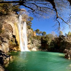
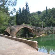
Sillans-la-Cascade is a commune in southern France centered around a waterfall that plunges approximately 44 meters down rocky cliffs surrounded by Mediterranean plants and trees. The village sits within rolling terrain with various pathways connecting the settlement to natural features and viewing points.

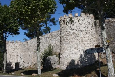
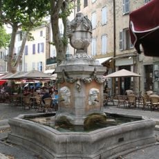
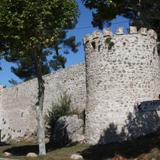
The settlement emerged as a strategic point in medieval times, positioned between Provence's mountain regions and coastal areas where it controlled important water supplies. This location allowed it to serve as a connecting point between different parts of the region for centuries.

The village hosts traditional summer festivals where locals celebrate regional customs through craft displays and cooking demonstrations that showcase the area's heritage.

Visitors can reach the waterfall area through marked trails starting from the village center, with parking spaces available nearby for easy access. The paths offer different difficulty levels and remain mostly passable throughout the year.

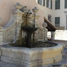
The village's name references a distinctive underground water system beneath the area that creates hidden channels emerging as springs scattered throughout the territory in unexpected places. These subterranean flows have shaped the landscape's character for generations.

Location: canton of Tavernes

Location: Var

Location: arrondissement of Draguignan

Elevation above the sea: 400 m

Shares border with: Riez, Aups, Cotignac, Fox-Amphoux, Pontevès, Salernes

Phone: +33494046304

Email: mairie.sillans-la-cascade@wanadoo.fr

Website: http://sillans-la-cascade.fr

GPS coordinates: 43.56778,6.17972

Latest update: December 20, 2025 02:27

Photos
Historical sites and natural landscapes in Provence region

The Provence-Alpes-Côte d'Azur region combines medieval villages, historical fortifications, and natural areas between the Mediterranean coast and the Alps. The landscape ranges from the lavender-covered plateaus of Valensole to the steep limestone cliffs of the Calanques and alpine passes above...

Reviews

Visited this place? Tap the stars to rate it and share your experience / photos with the community! Try now! You can cancel it anytime.

« Sillans-la-Cascade - Administrative commune in Provence-Alpes-Côte d'Azur, France » is provided by Around Us (aroundus.com). Images and texts are derived from Wikimedia project under a Creative Commons license. You are allowed to copy, distribute, and modify copies of this page, under the conditions set by the license, as long as this note is clearly visible.

Discover hidden gems everywhere you go!

From secret cafés to breathtaking viewpoints, skip the crowded tourist spots and find places that match your style. Our app makes it easy with voice search, smart filtering, route optimization, and insider tips from travelers worldwide. Download now for the complete mobile experience.

Around Us App Screenshot

A unique approach to discovering new places

Le Figaro

All the places worth exploring

France Info

A tailor-made excursion in just a few clicks

20 Minutes