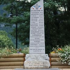
Vuache, Mountain summit in Haute-Savoie, France.
Vuache is a narrow limestone hogback ridge in Haute-Savoie, running through the communes of Chevrier, Vulbens, Dingy-en-Vuache, Savigny, Chaumont, and Clarafond-Arcine, with steep faces on both sides formed by sedimentary rock layers. The ridge runs roughly north to south and separates the flat land of the Geneva basin from the foothills closer to the Alps.
The name Vuache first appears in writing as Vaschium in 1173-1178, when it referred to the seigneurie centred on the castle of Vulbens, not the mountain. Between the 11th and 15th centuries the ridge itself carried other names, including Chaumont, Savigny, Chevrier, Sainte-Victoire, Arcine and Entremont. The word later shifted from the lordship to the mountain above Vulbens; the name montagne de Chaumont comes from the village of Chaumont at its southern end.
The name Vuache comes from Savoyard, where it is pronounced ouache or ouoss; the first written form, Vaschium, dates from 1173-1178. It may derive from old French wachas (marsh), linked to the damp clay soils of the Chevrier-Vulbens plain. The word later passed from the seigneurie centred on the castle of Vulbens to the mountain above it.
The D 908a runs along the eastern flank, where the tilted rock layers of the ridge can be read from the road. The crest is reached on foot; the northern shoulder above the Défilé de l'Écluse is a protected site. The ridge is 14 km long and only 1.5 to 3 km wide, so plan the crossing accordingly.
The Vuache is cut along its axis by the left-lateral Vuache fault, a weakly active fault that produced several moderate earthquakes in the 20th century. The largest recorded was the 1996 Annecy earthquake, magnitude 5.3, with its epicentre between Épagny and Sillingy, which caused damage in Annecy and its suburbs.
The community of curious travelers
AroundUs brings together thousands of curated places, local tips, and hidden gems, enriched daily by 94,441 contributors worldwide.