Kastelberg, Mountain summit in Vosges, France
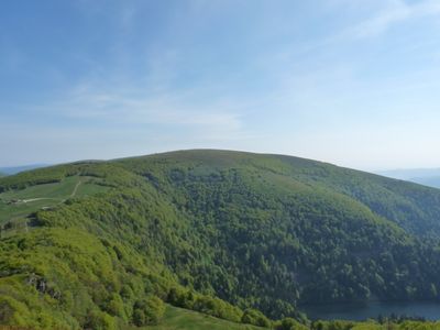
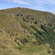
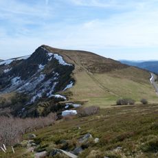
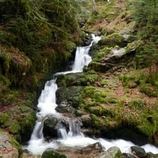
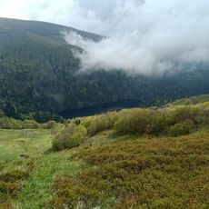
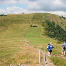
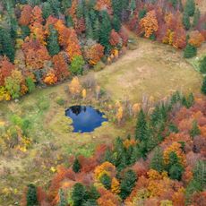
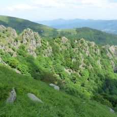
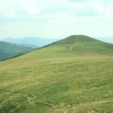
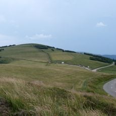
Kastelberg is a granite peak in the Vosges that rises to 1350 meters, making it the fourth highest mountain in the range. The summit sits above expansive meadows and steep woodland slopes that descend toward lower elevations.
The mountain sits in a region once divided between Alsace and Lorraine, a boundary that shaped settlement patterns and trade routes. This division influenced how communities developed on either side of the border.
Local herders have long grazed cattle on these slopes, shaping the pastoral landscape we see today. The open meadows around the summit reflect generations of agricultural use by mountain communities.
The summit can be reached by hiking trails from Col du Calvaire parking area or by ski runs from La Bresse resort depending on the season. Plan your visit around weather conditions, as snow and fog often cover the upper slopes.
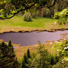
The Wormsawald-Ammelthal area holds snow patches that often linger into late summer on these slopes. These lingering snowfields create a distinctive landscape feature that sets this mountain apart from surrounding peaks.
Location: Vosges
Elevation above the sea: 1,350 m
Made from material: granite
GPS coordinates: 48.02137,7.00103
Latest update: December 13, 2025 12:41
Hohneck
2.1 km
Sentier des Roches
3.9 km
Rothenbachkopf
2.7 km
Charlemagne waterfall
3.6 km
Lac d'Altenweiher
1.1 km
Rainkopf
1.9 km
Jardin d'altitude du Haut Chitelet
3.4 km
Réserve naturelle nationale de Frankenthal-Missheimle
4.5 km
Église de l'Emm
5.6 km
Spitzkoepfe
1.5 km
Réserve naturelle nationale de la tourbière de Machais
3.5 km
Batteriekopf
3.4 km
Cascade de Retournemer
4.3 km
Schlitte Mountain
2.7 km
Cascade du Heidenbad
5.1 km
Martinswand
3 km
Le Schweisel
5.3 km
Réserve naturelle régionale des hautes-chaumes du Rothenbach
2.9 km
Form Aventures
5.2 km
Église Saints-Pierre-et-Paul de Wildenstein
5.8 km
Église de l'Immaculée Conception de Mittlach
3.1 km
Mairie-école de Metzeral
5.3 km
Croix de chemin de la route de Vologne
5.3 km
Croix de chemin des Feignes sous Vologne
3.4 km
Église luthérienne de Sondernach
6 km
Temple protestant
6 km
Croix de chemin de la route de Vologne
5.6 km
Mairie de Sondernach
6.1 kmVisited this place? Tap the stars to rate it and share your experience / photos with the community! Try now! You can cancel it anytime.
Discover hidden gems everywhere you go!
From secret cafés to breathtaking viewpoints, skip the crowded tourist spots and find places that match your style. Our app makes it easy with voice search, smart filtering, route optimization, and insider tips from travelers worldwide. Download now for the complete mobile experience.
A unique approach to discovering new places❞
— Le Figaro
All the places worth exploring❞
— France Info
A tailor-made excursion in just a few clicks❞
— 20 Minutes