Batteriekopf, Mountain summit in Haut-Rhin, France.
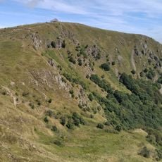
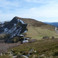
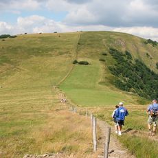
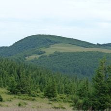
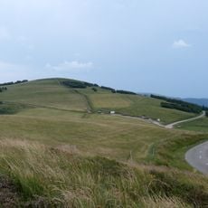
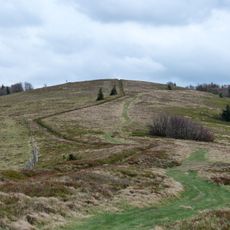
Batteriekopf is a rounded grassy summit in the Vosges, reaching 1311 metres on the border of Wildenstein and Metzeral, immediately south of the Rothenbachkopf. A narrow pale dirt path curves up its right-hand slope to the broad, gently domed crest and continues along the ridge. Low dark green shrubs and small trees cluster on the left flank.
The Route des Crêtes, laid out during the First World War, runs along the ridge bordering the Batteriekopf, immediately south of the Rothenbachkopf. The summit lies on the boundary between the communes of Wildenstein and Metzeral, in the Haut-Rhin department. The sources record no older history for the summit itself.
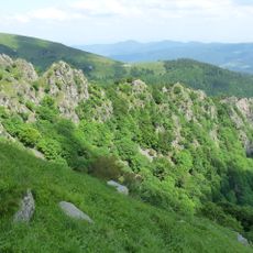
The summit lies on the border of Wildenstein and Metzeral, and the Route des Crêtes runs along the mountain. The south slope is used for slope soaring with radio-controlled gliders, flown when the wind comes from the east and lifts over the rocks.
The summit is reached on foot from the Rothenbachkopf along an easy ridge path, less than a kilometre away. The Route des Crêtes runs along the mountain's edge, giving road access to the trailheads. The south slope is used for slope soaring with radio-controlled gliders, best in an east wind.
The southern slope is used for slope soaring with radio-controlled gliders, and all glider categories can fly there in an east wind, with good lift above the rocks. The summit is less than a kilometre from the slightly higher Rothenbachkopf and is easily reached from it along a ridge.
The community of curious travelers
AroundUs brings together thousands of curated places, local tips, and hidden gems, enriched daily by 93,520 contributors worldwide.