Chest opened
+${chestReward.xp} XP
Explorer
NOUVEAU ×${chestReward.collectible.quantity}
tapez pour fermer

See the monuments around you in AR Open chests in the app

Around Us is built for your phone — point your camera at the streets and discover the monuments and places around you in augmented reality. Around Us is built for your phone — chests unlock when you walk, explore and capture nearby places.

•

Enable Location

We need your location to show you interesting places around you

Discover nearby places

Find interesting locations and hidden gems around you

Precise directions

Get accurate directions and distances to places

Your location is never shared with other users. It's only used when you tap the location button.

Alignements du Gueldro

Log in to your account

Start exploring — it's free

Trusted by 94,404 travelers worldwide

Continue with Google
Continue with Apple
or

We will send you a code to connect

By continuing, you accept our Terms and Conditions and our Privacy Policy

Check your inbox

We've sent a pincode in your inbox. Please enter the code below.

Alignements du Gueldro, Stone rows in Plouhinec, France

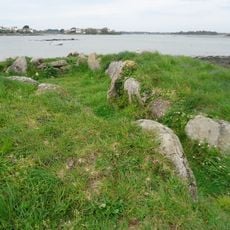
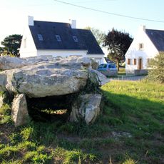
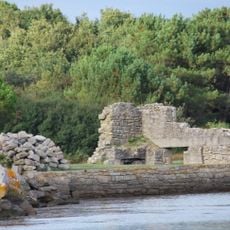
The Gueldro alignments are the remains of at least eight rows of menhirs at Plouhinec in Morbihan, of which 96 stones survive, some lying on the ground. The rows once ran for several kilometres and held stones 4 to 5 metres tall. In the grass, rough grey stones mottled with lichen stand in a line, one broad rounded stone low in the foreground and taller irregular slabs behind; a pale house with a dark pitched roof stands at the edge.

The stones were erected during the Neolithic period, likely thousands of years ago, serving ritual or navigational purposes for ancient populations. Official recognition came in 1963 when the French government protected the site as a classified historical monument.

The name Gueldro is also recorded as Kerzine, and the rows were once likened to a second Carnac. Two menhirs were broken by quarrymen in 1907, and stones were later moved several metres for road widening. During the Second World War, stones were taken for bunker construction.

The site is easily reached from the main road passing through Plouhinec village. Wear sturdy shoes, as the terrain is uneven and the stones sit directly on the ground surface.

At least eight rows of menhirs, some 4 to 5 metres tall, once ran for several kilometres here, leading to the nickname "a second Carnac". Most destruction happened in the 19th century, and during the Second World War stones were taken for bunkers. Two menhirs were broken by quarrymen in 1907.

The community of curious travelers

AroundUs brings together thousands of curated places, local tips, and hidden gems, enriched daily by 94,404 contributors worldwide.

Start exploring
Location
Address
Les Blés d'Or
GPS coordinates
47.68788,-3.25163
Latest update
November 1, 2026 00:36
Reviews
Share your experience

No review yet

Discussions
Start a discussion...

No discussion yet

« Alignements du Gueldro - Stone rows in Plouhinec, France » is provided by Around Us (aroundus.com). Images and texts are derived from Wikimedia project under a Creative Commons license. You are allowed to copy, distribute, and modify copies of this page, under the conditions set by the license, as long as this note is clearly visible.

Discover hidden gems everywhere you go!

From secret cafés to breathtaking viewpoints, skip the crowded tourist spots and find places that match your style. Our app makes it easy with voice search, smart filtering, route optimization, and insider tips from travelers worldwide. Download now for the complete mobile experience.
Around Us App Screenshot
❝

A unique approach to discovering new places❞

— Le Figaro

❝

All the places worth exploring❞

— France Info

❝

A tailor-made excursion in just a few clicks❞

— 20 Minutes

Around Us
Travel Guide & Maps
Download

Send to your phone

QR Code
1

Open the camera app on your mobile.

2

Point at the QR code with your camera. A notification will appear.

3

Tap the notification to open the link.