Glandieu Fall

Log in to your account

AroundUs is a community-driven map of interesting places, built by curious explorers like you. It grows with every review, story, and photo you share.
Connect to save your favorite spots, contribute locations, and create personalized routes.
Continue with Google
Continue with Apple
Continue with X
Continue with Facebook
Continue with email
By continuing, you accept our Terms and Conditions and our Privacy Policy
Create an account
Add to collection
Map
Suggest a change
Share

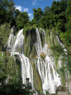
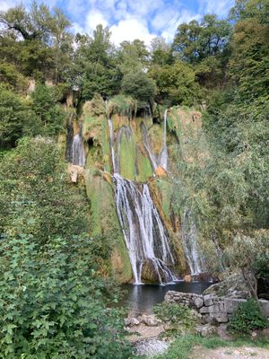
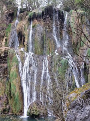
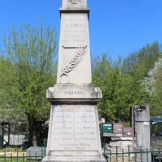
Glandieu Fall, Natural waterfall in Groslée-Saint-Benoît, France.

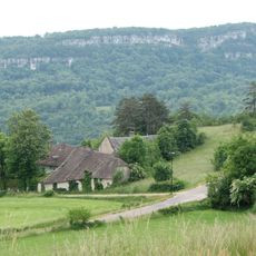
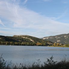
Glandieu Fall is a natural waterfall in Groslée-Saint-Benoît that descends in two distinct stages, carrying water from the Gland river into the Rhône river system at an elevation of approximately 210 meters. The site functions as a protected natural area managed for conservation purposes.

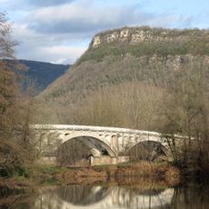
During the industrial era, a marble quarry near Brégnier-Cordon harnessed the waterfall's hydroelectric power to operate its extraction and processing works. This connection to industrial activity shaped how the site was used for centuries.

The waterfall is recognized as a protected natural site, reflecting local pride in preserving this landscape. Visitors notice how the flowing water shapes the character of the surrounding area and draws people to experience nature firsthand.

Two designated parking areas outside the hamlet provide vehicle access, though parking directly at the site is restricted. Visitors should prepare for a short walk from the parking area and wear proper footwear for uneven terrain.

Two separate hydroelectric stations continue to operate at this location, with each neighboring municipality managing its own facility. This arrangement shows how modern energy production and nature conservation coexist at the same site.

Location: Groslée-Saint-Benoît

Location: Brégnier-Cordon

Elevation above the sea: 210 m

Height: 60 m

Part of: Gland

Address: 926 Rue de la Cascade, 01300 Brégnier-Cordon, France

Website: http://bugeysud-tourisme.fr

GPS coordinates: 45.66528,5.61432

Latest update: December 6, 2025 17:41

Photos
Natural and cultural spots in Auvergne-Rhône-Alpes

The Auvergne-Rhône-Alpes region offers a mix of nature and history. Walking paths lead through valleys and past waterfalls, while medieval castles stand on hilltops and ridges. Volcanic peaks rise from the landscape, and caves open into the earth below. You will find the Massif Central, alpine...

Reviews

Visited this place? Tap the stars to rate it and share your experience / photos with the community! Try now! You can cancel it anytime.

« Glandieu Fall - Natural waterfall in Groslée-Saint-Benoît, France » is provided by Around Us (aroundus.com). Images and texts are derived from Wikimedia project under a Creative Commons license. You are allowed to copy, distribute, and modify copies of this page, under the conditions set by the license, as long as this note is clearly visible.

Discover hidden gems everywhere you go!

From secret cafés to breathtaking viewpoints, skip the crowded tourist spots and find places that match your style. Our app makes it easy with voice search, smart filtering, route optimization, and insider tips from travelers worldwide. Download now for the complete mobile experience.

Around Us App Screenshot

A unique approach to discovering new places

Le Figaro

All the places worth exploring

France Info

A tailor-made excursion in just a few clicks

20 Minutes