·

Enable Location

We need your location to show you interesting places around you

Discover nearby places

Find interesting locations and hidden gems around you

Precise directions

Get accurate directions and distances to places

Your location is never shared with other users. It's only used when you tap the location button.

Mount Baigura

Log in to your account

Start exploring — it's free

Trusted by 62,629 travelers worldwide

Continue with Google
Continue with Apple
or

We will send you a code to connect

By continuing, you accept our Terms and Conditions and our Privacy Policy

Check your inbox

We've sent a pincode in your inbox. Please enter the code below.

Mount Baigura

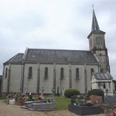
Mount Baigura, Mountain summit in Labourd, France.

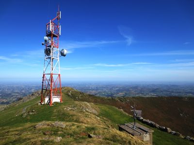
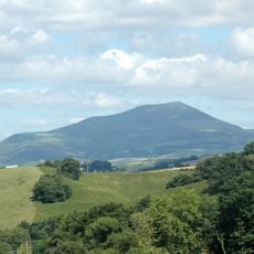
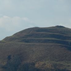
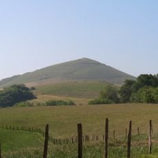
Mount Baigura rises to 897 meters and forms the highest point north of the Nive river basin. Its slopes are covered in grassland and rock formations, creating a prominent summit with views across the surrounding Pyrenean landscape.

The mountain's name comes from Basque language elements referring to river and valley, reflecting the region's geography. It has long served as a natural landmark for local communities and their pastoral way of life throughout history.

The mountain serves as grazing land for local herds, connecting it to traditional pastoral practices visible to anyone walking across its slopes. Pottok horses move freely through the pastures, embodying the link between the landscape and Basque rural life.

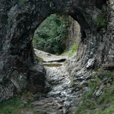
The summit is accessible via multiple trails from Heraitze village or a nearby leisure center, with the main route taking around five hours. Sturdy hiking boots and weather-appropriate clothing are essential, as conditions on the upper slopes can change quickly.

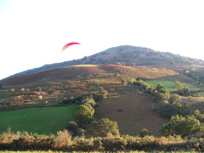
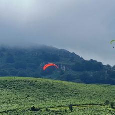
A paragliding launch site on the northern slope allows enthusiasts to take flight from this peak over the surrounding landscape. This use alongside hiking gives the mountain a distinctive dual role in local recreation.

The community of curious travelers

AroundUs brings together thousands of curated places, local tips, and hidden gems, enriched daily by 60,000 contributors worldwide.

Start exploring
Location
Location
Elevation above the sea
897 m
GPS coordinates
43.29050,-1.29289
Latest update
December 12, 2025 12:02
« Mount Baigura - Mountain summit in Labourd, France » is provided by Around Us (aroundus.com). Images and texts are derived from Wikimedia project under a Creative Commons license. You are allowed to copy, distribute, and modify copies of this page, under the conditions set by the license, as long as this note is clearly visible.

Discover hidden gems everywhere you go!

From secret cafés to breathtaking viewpoints, skip the crowded tourist spots and find places that match your style. Our app makes it easy with voice search, smart filtering, route optimization, and insider tips from travelers worldwide. Download now for the complete mobile experience.

Around Us App Screenshot

A unique approach to discovering new places

Le Figaro

All the places worth exploring

France Info

A tailor-made excursion in just a few clicks

20 Minutes

Around Us
Travel Guide & Maps
Download

Send to your phone

QR Code
1

Open the camera app on your mobile.

2

Point at the QR code with your camera. A notification will appear.

3

Tap the notification to open the link.