Mont Narcel, Mountain summit in Metropolis of Lyon, France
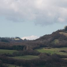
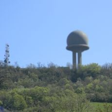
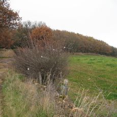
Mont Narcel rises to 582 meters within the Monts d'Or chain and is defined by steep slopes covered with diverse plants and vegetation. Natural water sources flow throughout the terrain, shaping the landscape and supporting the varied plant life.
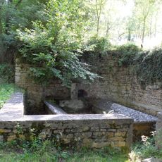
The mountain's name comes from the Latin word 'arca', meaning underground water channels that once supplied surrounding communities. These water systems were essential to how people settled and used the mountain.
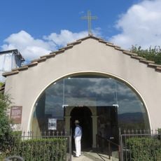
Local residents have built and maintained traditional dry stone structures called cabornes on the slopes, showing how people have lived with the mountain for generations. These small buildings reflect how locals adapted their building methods to the steep terrain.
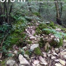
Multiple marked hiking trails connect to Lyon nearby and suit different fitness levels for visitors. Most routes are walkable year-round and well marked throughout the mountain.
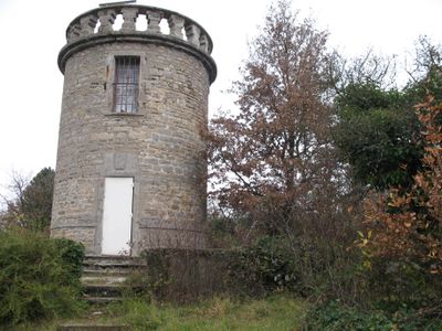
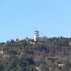
An old telegraph tower using the Chappe system still stands at the summit and shows how people communicated across distances long ago. Rare orchid species grow on the lower slopes, a detail that most visitors overlook.
Location: Metropolis of Lyon
Elevation above the sea: 582 m
GPS coordinates: 45.83943,4.78665
Latest update: December 14, 2025 20:05
Abode of Chaos
3.1 km
Mont Thou
859 m
Mont Cindre
3.1 km
Château de la Barollière
560 m
Fort du Mont Verdun
1.2 km
Monts d'Or Aqueduct
2.3 km
Château de Machy
3.3 km
Musée Ampère
1.9 km
Château de Saint-André du Coing
2.3 km
Château de la Guerrière
3.1 km
Manoir de Parsonge
3.2 km
Château de Sandar
1.7 km
Croix-Rampau
3.3 km
Batterie de la Freta
3.1 km
Saint-Fortunat chapel
1.7 km
Église Notre-Dame de Saint-Didier
3.4 km
MUSCO
3 km
Église Saint-Martin de Limonest
1.2 km
Église Saint-Romain de Saint-Romain-au-Mont-d'Or
2.8 km
Église Saint-Victor de Poleymieux-au-Mont-d'Or
2.4 km
Monument à Ampère
2.1 km
Ancienne église Saint-Victor
2.7 km
Madone de Couzon
3.1 km
Croix de chemin du chemin de la Bruyère
3 km
Chapelle de l'ermitage du Mont Cindre
3.3 km
Réservoirs d'aqueduc du Vallon d'Arche
2.3 km
Croix du Pinet
3.3 km
Chapelle de Bois Dieu
3.3 kmVisited this place? Tap the stars to rate it and share your experience / photos with the community! Try now! You can cancel it anytime.
Discover hidden gems everywhere you go!
From secret cafés to breathtaking viewpoints, skip the crowded tourist spots and find places that match your style. Our app makes it easy with voice search, smart filtering, route optimization, and insider tips from travelers worldwide. Download now for the complete mobile experience.
A unique approach to discovering new places❞
— Le Figaro
All the places worth exploring❞
— France Info
A tailor-made excursion in just a few clicks❞
— 20 Minutes