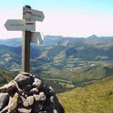
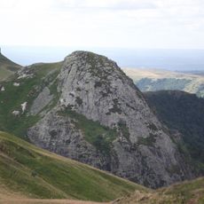
Pas de Peyrol, Mountain pass and free flight site in Cantal, France
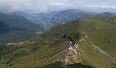
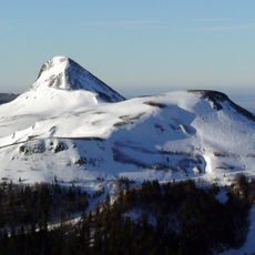
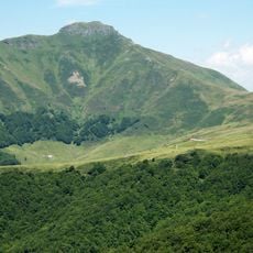
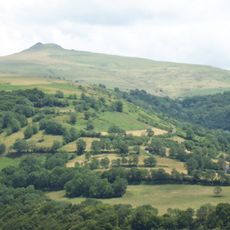
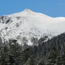
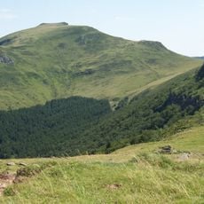
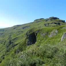
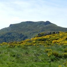
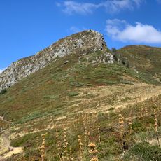
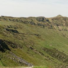
Pas de Peyrol is a mountain pass and free flight launch site in the Massif Central, reaching about 1,600 meters (5,250 feet) elevation. The road connects multiple routes through steep sections with sharp curves and narrow stretches that make driving challenging.
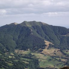
The pass entered the Tour de France in 1959 and became a key mountain stage in the race's route through the decades. Its steep terrain made it a defining challenge for professional cyclists competing in one of the world's most demanding cycling events.
Cyclists and hikers visit to test themselves against the mountain, and the pass holds significance for people seeking outdoor challenge in the Massif Central. Locals and visitors alike use this spot as a place to measure their endurance and connect with the landscape.
The road is closed to buses and trucks and requires careful driving on narrow curves and steep slopes. Visitors should drive slowly and watch for cyclists and motorcyclists who frequently use the pass for training.
The final section of the climb grows progressively steeper, with gradients reaching very challenging levels near the summit. This part is where cyclists most often reach their physical limits, making it a testing ground for endurance.
Elevation above the sea: 1,589 m
GPS coordinates: 45.11410,2.67175
Latest update: December 6, 2025 17:40
France offers motorcyclists a diverse landscape, from Alpine peaks to Mediterranean coasts, including wine regions. The country is suitable for all riding styles, with demanding mountain roads, winding coastal routes, and rural paths. Key routes include the Col de la Bonette, reaching 2802 meters...
Cantal mountains
4.6 km
Puy Mary
640 m
Parc Naturel Régional des Volcans d'Auvergne
64 km
Puy Griou
4.6 km
Puy de Peyre-Arse
3.1 km
Puy Violent
6.7 km
Téton de Vénus
4.7 km
Puy Chavaroche
2.9 km
Château d'eau du Lioran
6.8 km
Puy du Rocher
9.1 km
Cascade de Faillitoux
9.3 km
Puy de Seycheuse
6.6 km
Roc d'Hozières
2.3 km
Cascade de Liadouze
4 km
L'Élancèze
7 km
Bec de l'Aigle
5.6 km
Puy Bataillouse
4.1 km
Puy de Massebœuf
6.5 km
Grotte de la Bade
9.1 km
Église Saint-Germain du Falgoux
6 km
Église Saint-Julien de Saint-Julien-de-Jordanne
6.2 km
Église Saint-Jean-Baptiste du Claux
5.9 km
Saint-Jacques de Saint-Jacques-des-Blats Church
7.5 km
Église Saint-Laurent de Mandailles
5.3 km
Oratoire du Sartre
8.2 km
Moulin de Drils
8.4 km
Maison Saury
5.7 km
Puy de la Tourte
1.2 kmVisited this place? Tap the stars to rate it and share your experience / photos with the community! Try now! You can cancel it anytime.
Discover hidden gems everywhere you go!
From secret cafés to breathtaking viewpoints, skip the crowded tourist spots and find places that match your style. Our app makes it easy with voice search, smart filtering, route optimization, and insider tips from travelers worldwide. Download now for the complete mobile experience.
A unique approach to discovering new places❞
— Le Figaro
All the places worth exploring❞
— France Info
A tailor-made excursion in just a few clicks❞
— 20 Minutes