Enable Location

We need your location to show you interesting places around you

Discover nearby places

Find interesting locations and hidden gems around you

Precise directions

Get accurate directions and distances to places

Your location is never shared with other users. It's only used when you tap the location button.

Quai de Valmy

Log in to your account

Start exploring — it's free

Trusted by 62,067 travelers worldwide

Continue with Google
Continue with Apple
or

We will send you a code to connect

By continuing, you accept our Terms and Conditions and our Privacy Policy

Check your inbox

We've sent a pincode in your inbox. Please enter the code below.

Quai de Valmy

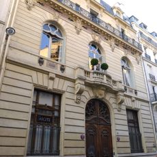
Quai de Valmy, Riverfront in 10th arrondissement of Paris, France

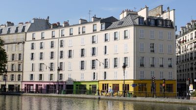
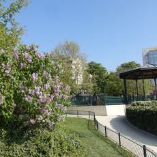
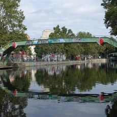
The Quai de Valmy runs alongside the Canal Saint-Martin with paved walkways that give direct access to the water in the northeastern part of the city. The waterside path stretches across a lengthy section and connects two different neighborhoods.

The quai was built in 1824 as part of Paris' urban development following the Napoleonic era. This period represented the city's push toward creating modern waterside infrastructure.

The name honors the Battle of Valmy, showing how France commemorates military events through street names in the city. You can feel this connection to the past as you walk along the canal.

The paved path accommodates both pedestrians and cyclists with sturdy surfaces that are easy to walk on. Access is open and free, with clear landmarks along the canal to help you find your way.

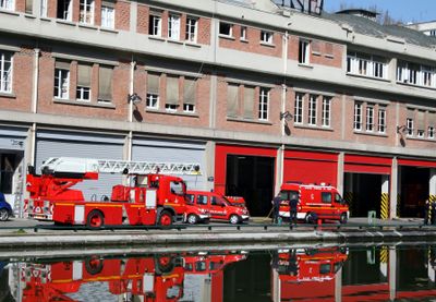
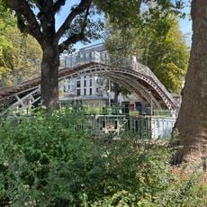
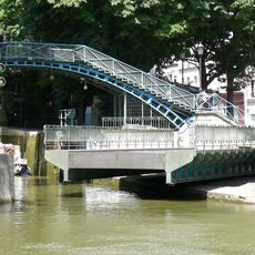
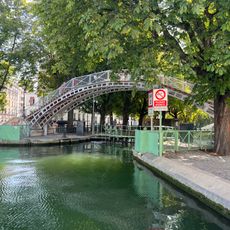
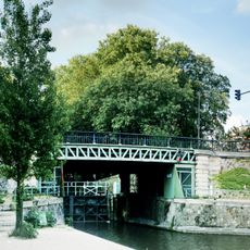
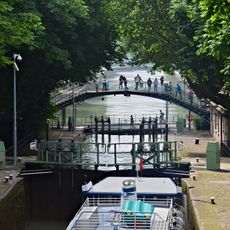
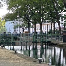
The waterside features iron footbridges and water locks that allow boats to move between different water levels on the canal. This practical engineering solution makes the canal a working waterway that visitors often pass by without noticing.

The community of curious travelers

AroundUs brings together thousands of curated places, local tips, and hidden gems, enriched daily by 60,000 contributors worldwide.

Start exploring
Inception
1824
Length
1,720 m
Width
11.5 m
Part of
road network of Paris
Shares border with
allée du Professeur-Jean-Bernard, boulevard de la Villette, boulevard Jules-Ferry, passage Delessert, place de la Bataille-de-Stalingrad, Place Raoul-Follereau, rue Alexandre-Parodi, rue Beaurepaire, rue de Lancry, rue de Marseille, rue des Récollets, rue Dieu, rue du Commandant-Mortenol, rue du Faubourg-du-Temple, rue Eugène-Varlin, rue Jean-Poulmarch, rue La Fayette, rue Léon-Jouhaux, rue Louis-Blanc, rue Lucien-Sampaix, Rue Monseigneur-Rodhain
GPS coordinates
48.87490,2.36303
Latest update
December 11, 2025 11:03
« Quai de Valmy - Riverfront in 10th arrondissement of Paris, France » is provided by Around Us (aroundus.com). Images and texts are derived from Wikimedia project under a Creative Commons license. You are allowed to copy, distribute, and modify copies of this page, under the conditions set by the license, as long as this note is clearly visible.

Discover hidden gems everywhere you go!

From secret cafés to breathtaking viewpoints, skip the crowded tourist spots and find places that match your style. Our app makes it easy with voice search, smart filtering, route optimization, and insider tips from travelers worldwide. Download now for the complete mobile experience.

Around Us App Screenshot

A unique approach to discovering new places

Le Figaro

All the places worth exploring

France Info

A tailor-made excursion in just a few clicks

20 Minutes

Around Us
Travel Guide & Maps
Download

Send to your phone

QR Code
1

Open the camera app on your mobile.

2

Point at the QR code with your camera. A notification will appear.

3

Tap the notification to open the link.