Enable Location

We need your location to show you interesting places around you

Discover nearby places

Find interesting locations and hidden gems around you

Precise directions

Get accurate directions and distances to places

Your location is never shared with other users. It's only used when you tap the location button.

Quai de la Loire

Log in to your account

Start exploring — it's free

Trusted by 61,499 travelers worldwide

Continue with Google
Continue with Apple
or

We will send you a code to connect

By continuing, you accept our Terms and Conditions and our Privacy Policy

Check your inbox

We've sent a pincode in your inbox. Please enter the code below.

Quai de la Loire

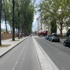
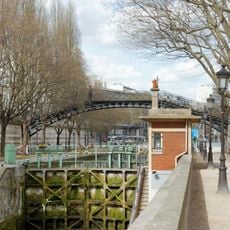
Quai de la Loire, Riverfront path in 19th arrondissement, France

Description

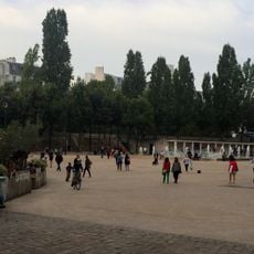
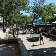
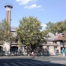
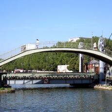
Quai de la Loire is an 850-meter-long waterfront path in the 19th arrondissement that runs alongside the canal. The roughly 12-meter wide walkway accommodates pedestrians and cyclists while connecting different parts of the Villette neighborhood.

History

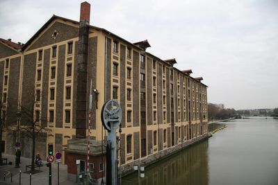
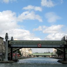
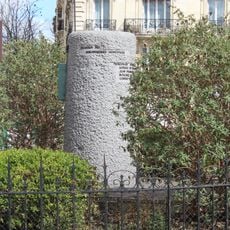
The waterfront path developed following the canal's construction in the early 1800s and acquired its current name in 1857. Originally an industrial zone with warehouses, the area gradually transitioned into what visitors see today.

Culture

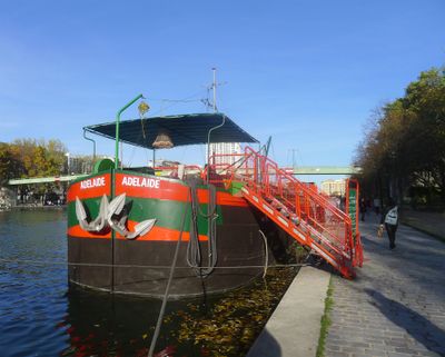
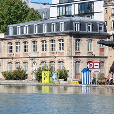
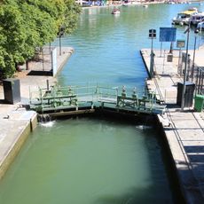
The quay evolved into a hub for water sports and recreation, where visitors can paddle kayaks and explore the canal today. The surrounding buildings show how this area transformed from industrial work into a place where people enjoy leisure activities.

Practical

The path is easily accessible from the Jaurès metro exit, providing convenient entry to the area. The flat, wide surface makes it suitable for walking or cycling, and you can explore it in either direction at your own pace.

Did you know?

Several buildings along the quay served as filming locations for the 1981 film Diva, giving the area a distinct connection to cinema history. These structures still bear traces of that production and highlight their role in French film heritage.

Inception
1857
Length
850 m
Width
12 m
Part of
road network of Paris
Shares border with
place de la Bataille-de-Stalingrad, rue de Colmar, rue de Crimée, rue de la Moselle, rue Euryale-Dehaynin, rue Henri-Noguères, rue Vincent-Scotto, avenue Jean-Jaurès
GPS coordinates
48.88570,2.37538
Latest update
December 12, 2025 14:24

AroundUs brings together thousands of curated places, local tips, and hidden gems, enriched daily by 60,000 contributors worldwide. Discover all places nearby (19th arrondissement of Paris).

« Quai de la Loire - Riverfront path in 19th arrondissement, France » is provided by Around Us (aroundus.com). Images and texts are derived from Wikimedia project under a Creative Commons license. You are allowed to copy, distribute, and modify copies of this page, under the conditions set by the license, as long as this note is clearly visible.

Discover hidden gems everywhere you go!

From secret cafés to breathtaking viewpoints, skip the crowded tourist spots and find places that match your style. Our app makes it easy with voice search, smart filtering, route optimization, and insider tips from travelers worldwide. Download now for the complete mobile experience.

Around Us App Screenshot

A unique approach to discovering new places

Le Figaro

All the places worth exploring

France Info

A tailor-made excursion in just a few clicks

20 Minutes

Around Us
Travel Guide & Maps
Download

Send to your phone

QR Code
1

Open the camera app on your mobile.

2

Point at the QR code with your camera. A notification will appear.

3

Tap the notification to open the link.