Îlet à Cabrit, Small islet near Terre-de-Haut, Guadeloupe
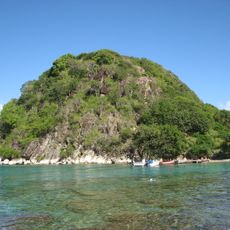
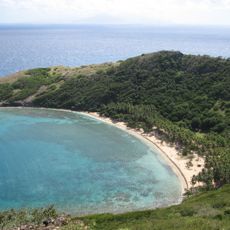
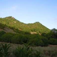
Îlet à Cabrit is an uninhabited islet about 1 km northwest of Terre-de-Haut, partly closing the Baie des Saintes. It measures roughly 1.2 km east to west and 750 m north to south, with three headlands—Pointe à Cabrit, Pointe Sable and Pointe Bombarde—framing three coves. Its highest point, about 85 m, is the site of Fort Joséphine.
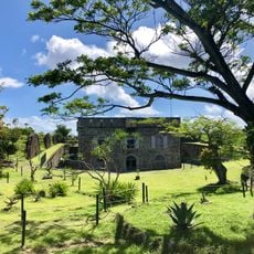
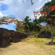
Called Petite Martinique in the 18th century, the islet served as a lookout over the passes into the Baie des Saintes. In 1777 France built Fort de la Reine on the summit, renamed Fort Joséphine in 1805; the British, masters of Les Saintes in 1809, kept it and added a cistern. It became a penitentiary in 1851, was wrecked by a hurricane on 6 September 1865, and held convicts bound for Cayenne until 1902. A lazaretto for Indian indentured immigrants opened in 1871.
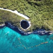
The name Cabrit comes from the goats that Saintois farmers once grazed here. The islet also marks the two channels into the bay, la Baleine to the east and Pain de Sucre to the south, which sailors use to reach the harbours of Mouillage and Fond-du-Curé. Divers head for the Trou à Diable at the tip of Pointe à Cabrit.
Regular boat services connect Terre-de-Haut to the islet, with crossing times varying based on weather and sea conditions. Visitors should bring swimwear, sun protection, and waterproof containers to make the most of time in the water.
The waters around the islet hold specialized coral formations that shelter and feed a diverse marine community. These reefs regularly attract different fish species that are less common in other parts of the archipelago.
The community of curious travelers
AroundUs brings together thousands of curated places, local tips, and hidden gems, enriched daily by 93,471 contributors worldwide.