Pic de Petit Rochebrune, Alpine summit in Provence-Alpes-Côte d'Azur, France
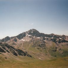
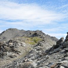
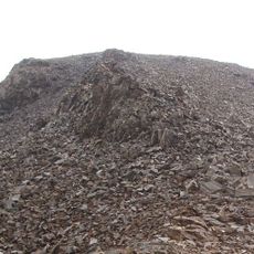
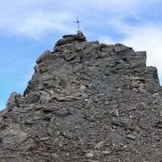
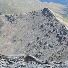
Pic de Petit Rochebrune is a 3,078 m summit in the Cottian Alps, on the ridge between the Cerveyrette and Guil valleys. Its upper part is dark grey fractured rock with narrow ridges and gullies; a diagonal band of lighter scree crosses the middle, and pale scree and gravel cover the lower slopes, with a patch of yellowish-green grass on the lower right.
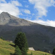
The summit lies on the ridge between the Guil valley, the Queyras, and the Cerveyrette valley, shared by the municipalities of Cervières and Aiguilles. Since 1977 it has stood on the northern border of the Parc naturel régional du Queyras. Its 3,078 m altitude places it below the neighbouring Pic de Rochebrune, which gave it the name Petit.
The name translates from French as "small dark rock peak": "petit" because it is lower than the neighbouring Pic de Rochebrune, and "roche brune" for the dark rock of the massif. In Occitan the mountain is called Pica de Pichon Ròca Bruna. The summit ridge forms the border of the Queyras Regional Nature Park, created in 1977.
The ascent starts from Les Fonts village in Cervières, where a mountain refuge partway up provides shelter for overnight stays. Proper hiking boots and mountain experience are necessary for the climb.
The summit reaches 3,078 m and stands on the ridge between the Cerveyrette valley and the Guil valley, the Queyras. A northern spur branching from the peak carries the Pic Lombard and divides the upper Cerveyrette into two arms.
The community of curious travelers
AroundUs brings together thousands of curated places, local tips, and hidden gems, enriched daily by 92,895 contributors worldwide.