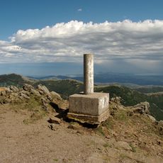
Puig de Pradets, Mountain peak in Eastern Pyrenees, Spain and France.
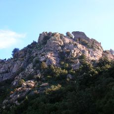
Puig de Pradets is a summit of 1,176 metres on the border between Espolla (Alt Empordà) and Sorède (Rosselló), in the Serra de l'Albera. Its top is a dry-stone cairn of flat grey rocks with a tilted dark pole and a square metal sign, standing on rough, pebbly, grass-covered ground. The sources give 1,167 metres for the same peak.
The peak has served as a natural border marker between Spain and France since 1659 when the Treaty of the Pyrenees was signed. This agreement shaped the political boundaries and gave the mountain its role as a symbolic divide between two nations.
Herders from both Espolla and Sorède practice traditional grazing on the mountain slopes at different times of year. This long-standing way of working shapes how the land looks and how local people relate to it.
Hiking routes are available from both sides, with the southern approach offering a gentler climb through oak woodlands. The northern route is steeper and requires more sure-footedness, so visitors should consider their abilities and plan their timing accordingly.
The summit carries a dry-stone cairn of flat grey rocks topped by a thin, tilted pole with a square metal sign whose text has faded away. A wire runs from the pole down over the stones. The cairn stands on rough, pebbly, grass-covered ground, and the sources give the height as 1,167 m in one account and 1,176 m in another.
The community of curious travelers
AroundUs brings together thousands of curated places, local tips, and hidden gems, enriched daily by 93,971 contributors worldwide.