Chest opened
+${chestReward.xp} XP
Explorer
NOUVEAU ×${chestReward.collectible.quantity}
tapez pour fermer
Chest locked

Open chests in the app

Around Us is built for your phone — chests unlock when you walk, explore and capture nearby places.

Enable Location

We need your location to show you interesting places around you

Discover nearby places

Find interesting locations and hidden gems around you

Precise directions

Get accurate directions and distances to places

Your location is never shared with other users. It's only used when you tap the location button.

Réseau de la Woëvre

Log in to your account

Start exploring — it's free

Trusted by 73,043 travelers worldwide

Continue with Google
Continue with Apple
or

We will send you a code to connect

By continuing, you accept our Terms and Conditions and our Privacy Policy

Check your inbox

We've sent a pincode in your inbox. Please enter the code below.

Réseau de la Woëvre
Discussion Reviews 1 Photos
17.7k Popularity

Réseau de la Woëvre, réseau de chemin de fer dans la Meuse (1914-1938)

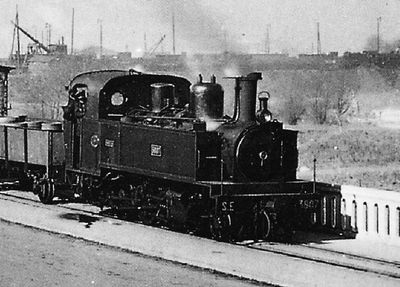
The Réseau de la Woëvre was a narrow-gauge railway network (meter gauge) built in the early 20th century through the Meuse department, spanning about 149 kilometers. It consisted of two main lines: one from Verdun to Montmédy and another from Vaux-devant-Damloup to Commercy, each with independent tracks that wound through fields and small towns.

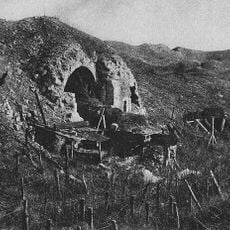
The network opened in 1914, shortly after World War I began, and operated until 1938. During the war it served military supply purposes, with the front line splitting the system in two places and Germans controlling the northern section, which was renamed Montmédy-Süd during occupation.

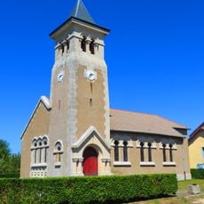
The network shaped the identity of small villages and towns in the region, where Montmédy station became a center of community life. Local people relied on trains to move goods and connect places, and these memories still echo in residents' stories today.

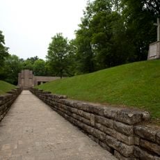
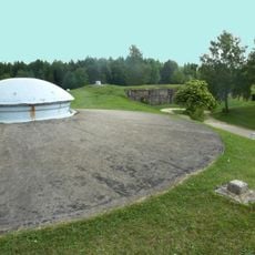
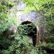
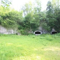
You can walk or cycle along the old route sections today, as many have been converted into walking and cycling trails. Remnants of stations and bridges remain visible along the route, particularly at Montmédy, where the former station has been converted into a community space.

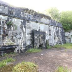
Montmédy station was renamed Montmédy-Sud during German occupation, a rare reminder of the occupation's impact on local infrastructure. Today the old station building has been transformed into a community hall where markets and festivals take place, allowing visitors to still see remnants of tracks alongside.

The community of curious travelers

AroundUs brings together thousands of curated places, local tips, and hidden gems, enriched daily by 60,000 contributors worldwide.

Start exploring
Location
Official opening
1914
GPS coordinates
49.21127,5.47467
Latest update
February 17, 2026 00:20
Reviews
Share your experience

No review yet

Discussions
Start a discussion...

No discussion yet

« Réseau de la Woëvre - réseau de chemin de fer dans la Meuse (1914-1938) » is provided by Around Us (aroundus.com). Images and texts are derived from Wikimedia project under a Creative Commons license. You are allowed to copy, distribute, and modify copies of this page, under the conditions set by the license, as long as this note is clearly visible.

Discover hidden gems everywhere you go!

From secret cafés to breathtaking viewpoints, skip the crowded tourist spots and find places that match your style. Our app makes it easy with voice search, smart filtering, route optimization, and insider tips from travelers worldwide. Download now for the complete mobile experience.

Around Us App Screenshot

A unique approach to discovering new places

Le Figaro

All the places worth exploring

France Info

A tailor-made excursion in just a few clicks

20 Minutes

Around Us
Travel Guide & Maps
Download

Send to your phone

QR Code
1

Open the camera app on your mobile.

2

Point at the QR code with your camera. A notification will appear.

3

Tap the notification to open the link.