Enable Location

We need your location to show you interesting places around you

Discover nearby places

Find interesting locations and hidden gems around you

Precise directions

Get accurate directions and distances to places

Your location is never shared with other users. It's only used when you tap the location button.

Pic de Cambalès

Log in to your account

Start exploring — it's free

Trusted by 62,492 travelers worldwide

Continue with Google
Continue with Apple
or

We will send you a code to connect

By continuing, you accept our Terms and Conditions and our Privacy Policy

Check your inbox

We've sent a pincode in your inbox. Please enter the code below.

Pic de Cambalès

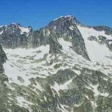
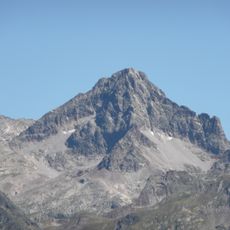
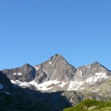
Pic de Cambalès, Granite summit in Hautes-Pyrénées, France.

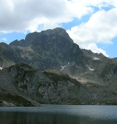
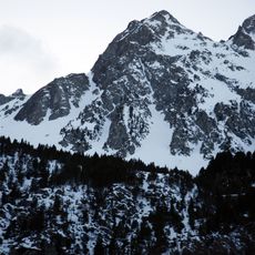
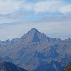
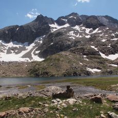
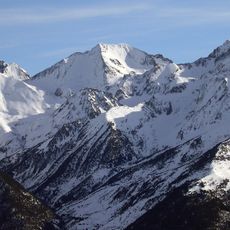
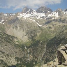
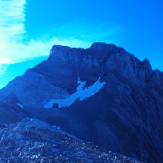
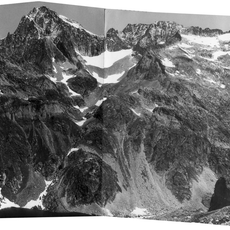
Pico de Cambalés is a granite summit in the Hautes-Pyrénées rising to 2965 meters, characterized by steep northern cliffs roughly 200 meters high. The peak sits within the Marcadau massif and displays dramatic rock faces on its northern aspect.

French mountaineer Henry Russell made the first recorded ascent on July 20, 1877, establishing a climbing route. This early climb was part of the broader 19th-century exploration of the Pyrenees.

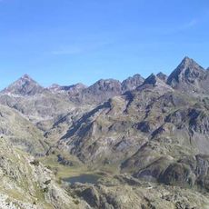
The summit forms a natural boundary between France and Spain, dividing two watershed systems. Visitors crossing the ridge can sense this geographical division as the landscape shifts between the two sides.

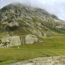
The route begins from Refuge Wallon at 1866 meters and involves a full-day hike with significant elevation gain. Plan to start early, wait for good weather, and allow ample time for both ascent and descent.

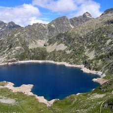
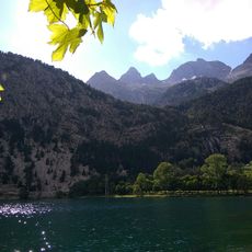
Two small lakes near Col d'Aragon at 2808 meters rank among the highest water bodies in this Pyrenees section. These alpine pools sit just below the peak and form surprisingly accessible mountain lakes at such high elevation.

The community of curious travelers

AroundUs brings together thousands of curated places, local tips, and hidden gems, enriched daily by 60,000 contributors worldwide.

Start exploring
Elevation above the sea
2,965 m
Made from material
granite
GPS coordinates
42.82361,-0.24355
Latest update
December 14, 2025 20:27
« Pic de Cambalès - Granite summit in Hautes-Pyrénées, France » is provided by Around Us (aroundus.com). Images and texts are derived from Wikimedia project under a Creative Commons license. You are allowed to copy, distribute, and modify copies of this page, under the conditions set by the license, as long as this note is clearly visible.

Discover hidden gems everywhere you go!

From secret cafés to breathtaking viewpoints, skip the crowded tourist spots and find places that match your style. Our app makes it easy with voice search, smart filtering, route optimization, and insider tips from travelers worldwide. Download now for the complete mobile experience.

Around Us App Screenshot

A unique approach to discovering new places

Le Figaro

All the places worth exploring

France Info

A tailor-made excursion in just a few clicks

20 Minutes

Around Us
Travel Guide & Maps
Download

Send to your phone

QR Code
1

Open the camera app on your mobile.

2

Point at the QR code with your camera. A notification will appear.

3

Tap the notification to open the link.