Oppidum des Châteliers, Archaeological site in Amboise, France.
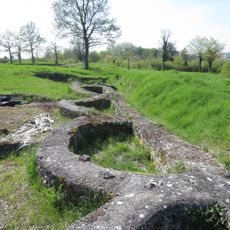
The Oppidum des Châteliers is an archaeological site spread across a limestone plateau with visible remains of temples, homes, and craft workshops from ancient times. The location sits elevated overlooking where two rivers meet, creating natural defensive advantages still marked by ancient rampart systems.
This settlement developed around 400 BCE as a fortified center for the Turones people and remained their main hub until Roman conquest around 50 BCE. During these centuries the site grew larger and became increasingly important for trade and tribal identity in the region.
The settlement functioned as a religious and economic hub where residents built temples, lived in organized neighborhoods, and practiced various crafts. Visitors walking through can still sense the layout that governed daily life in this ancient community.
The site is accessible but some rampart structures are faint and partly on private land that may limit exploration in certain areas. It helps to walk slowly across the plateau and watch for ground irregularities that reveal traces of ancient buildings and fortifications.
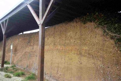
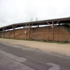
At the center of the site stands a distinctive earthen mound that may originate from the Bronze Age and was later incorporated into the Celtic fortifications. This ancient feature reveals how settlers reused the landscape across different periods, layering new purposes onto old structures.
The community of curious travelers
AroundUs brings together thousands of curated places, local tips, and hidden gems, enriched daily by 60,000 contributors worldwide.