Montagne Kwata, Hill summit in French Guiana, France.
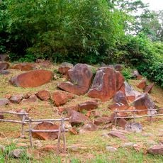
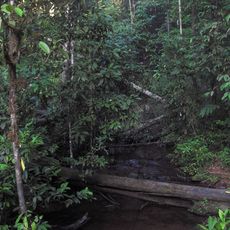
Montagne Kwata is a hilltop in northern French Guiana that rises above the surrounding rainforest with a distinctive reddish laterite surface. The elevation stands out clearly from the dense vegetation below and creates a visible landmark in the otherwise low-lying landscape.
This location was first documented in international geographic databases and has long served as a reference point for people navigating the region. Its geographic position was formally recorded through modern surveying methods and mapping systems.
Local communities use this elevation as a natural landmark when moving through the forest, and it serves as a reference point during seasonal activities and daily journeys. The site holds practical meaning in how people navigate and understand the landscape around them.
Visitors should arrange guides in advance and prepare for hot, humid conditions typical of tropical rainforests in this region. The best time to visit is during drier months when hiking conditions are more manageable.
The weather and plant life differ noticeably depending on which side of the elevation you visit, since the height affects wind patterns and moisture conditions. These natural variations create distinct ecosystems within a small area.
The community of curious travelers
AroundUs brings together thousands of curated places, local tips, and hidden gems, enriched daily by 60,000 contributors worldwide.