Chest opened
+${chestReward.xp} XP
Explorer
NOUVEAU ×${chestReward.collectible.quantity}
tapez pour fermer
Chest locked

Open chests in the app

Around Us is built for your phone — chests unlock when you walk, explore and capture nearby places.

Enable Location

We need your location to show you interesting places around you

Discover nearby places

Find interesting locations and hidden gems around you

Precise directions

Get accurate directions and distances to places

Your location is never shared with other users. It's only used when you tap the location button.

Log in to your account

Start exploring — it's free

Trusted by 72,883 travelers worldwide

Continue with Google
Continue with Apple
or

We will send you a code to connect

By continuing, you accept our Terms and Conditions and our Privacy Policy

Check your inbox

We've sent a pincode in your inbox. Please enter the code below.

Pic de la Coumeille
Discussion Reviews Photo
30+ Popularity

Pic de la Coumeille, Mountain peak in Eastern Pyrenees, France

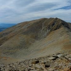
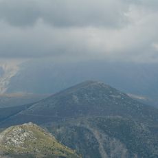
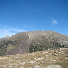
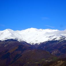
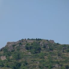
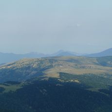
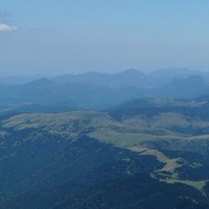
Pic de la Coumeille is a mountain peak in the Eastern Pyrenees that reaches approximately 1500 meters and overlooks the Canigou massif and surrounding ridges. The mountain features wooded slopes that gradually give way to open rocky terrain near the summit.

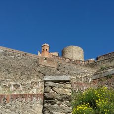
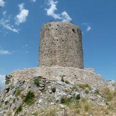
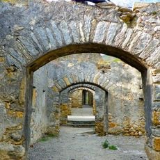
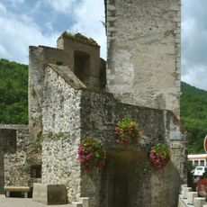
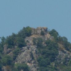
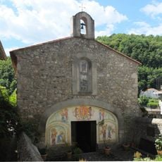
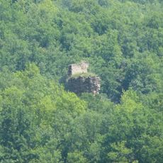
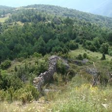
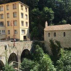
The peak overlooks Fort Lagarde, a fortress built in 1677 as part of French border defenses against Spanish attacks. This fortification shows how strategically important this area was during historical conflicts between France and Spain.

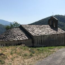
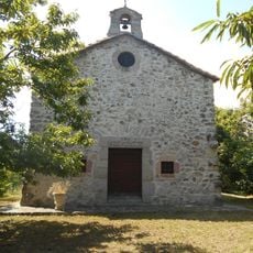
The trails pass through areas where Catalan herders have grazed animals for generations, and this pastoral tradition still shapes the appearance of the mountain landscape today.

The climb starts from the parking area in Prats-de-Mollo town center and follows marked trails through wooded sections until reaching more open ground. Bring plenty of water and be prepared for sudden weather changes, especially on the exposed upper slopes.

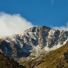
The climb passes through three distinct ecosystems: Mediterranean forest, alpine meadows, and rocky alpine zones, each with its own plant communities. This succession of different vegetation zones makes the mountain a window into how mountain ecology changes with elevation.

The community of curious travelers

AroundUs brings together thousands of curated places, local tips, and hidden gems, enriched daily by 60,000 contributors worldwide.

Start exploring
Elevation above the sea
1,524 m
GPS coordinates
42.43797,2.47043
Latest update
December 15, 2025 13:25
Reviews
Share your experience

No review yet

Discussions
Start a discussion...

No discussion yet

« Pic de la Coumeille - Mountain peak in Eastern Pyrenees, France » is provided by Around Us (aroundus.com). Images and texts are derived from Wikimedia project under a Creative Commons license. You are allowed to copy, distribute, and modify copies of this page, under the conditions set by the license, as long as this note is clearly visible.

Discover hidden gems everywhere you go!

From secret cafés to breathtaking viewpoints, skip the crowded tourist spots and find places that match your style. Our app makes it easy with voice search, smart filtering, route optimization, and insider tips from travelers worldwide. Download now for the complete mobile experience.

Around Us App Screenshot

A unique approach to discovering new places

Le Figaro

All the places worth exploring

France Info

A tailor-made excursion in just a few clicks

20 Minutes

Around Us
Travel Guide & Maps
Download

Send to your phone

QR Code
1

Open the camera app on your mobile.

2

Point at the QR code with your camera. A notification will appear.

3

Tap the notification to open the link.