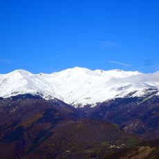
Puig Roja, Mountain summit in the Canigou massif, Eastern Pyrenees, France.
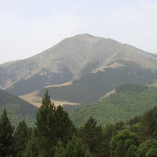
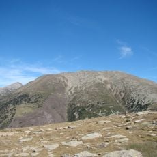
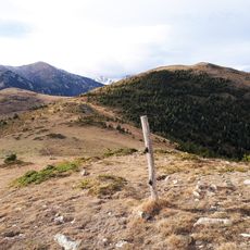
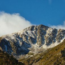
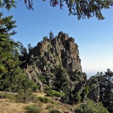
Puig Roja is a 2,720 m summit in the Canigou massif, formed by two rounded knolls of equal height about 200 m apart; the northern knoll carries a boundary marker. Its upper slopes are bare rock and dry ochre earth, with grey slabs and scree on the flanks and a green grassy slope rising from the lower right.
The summit marks the meeting point of Casteil, Prats-de-Mollo-la-Preste and Le Tech, and its northern knoll carries a boundary stone. The two rounded tops, of equal height and about 200 metres apart, are named in Catalan and French sources as Puig Rojà or pic Rougeat. The peak forms part of the southern access routes to Canigou.
The summit marks the meeting point of Casteil, Prats-de-Mollo-la-Preste and Le Tech, and its name is Catalan: rojà means reddish, after the ochre and tan earth of the upper slopes. The northern of its two rounded tops carries a boundary stone, a fita termenal, that walkers can look for.
The route to the summit starts at the Estables refuge and follows a trail to Col de la Régine with access to several ridge peaks. Rocky sections along the way require careful footing and proper hiking boots.
From this peak, the view extends across the Vallespir valley and stretches to the Mediterranean Sea beyond the Albères mountains. On clear days, the sight lines reach across multiple ridges and down to the sea.
The community of curious travelers
AroundUs brings together thousands of curated places, local tips, and hidden gems, enriched daily by 94,358 contributors worldwide.