La Dent du Loup, Mountain summit in the Vercors Massif, Isère, France
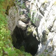
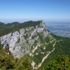
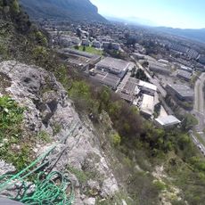
La Dent du Loup is a summit in the Vercors Massif, rising to 1,377 metres. It lies about 9.5 km north-west of Grenoble, with wooded slopes and other peaks rising to 1,589 metres within 1.2 km to the south-west.
This peak took its present form during the Alpine mountain-building period when tectonic forces pushed and shaped the landscape. The limestone layers visible today accumulated from ancient marine deposits over millions of years.
The name "Dent du Loup" means "wolf's tooth", referring to the jagged rock tooth of this 1,377 m summit in the Vercors. It rises about 9.5 km north-west of Grenoble, so the peak is a familiar landmark on the skyline above the city.
La Dent du Loup lies about 9.5 km northeast of Grenoble, on the edge of the Vercors forests above the Isère valley. The summit stands at 1,377 m, with a higher point of 1,589 m about 1.2 km away. Approach on foot through the woods; the terrain is uneven and steepens near the top, so wear sturdy hiking boots.
La Dent du Loup rises to 1,377 metres, about 9.5 km north-west of Grenoble, and the land within 1.2 km to the north-east reaches 1,589 metres. The summit is a rocky point on a wooded slope of the Vercors, so the higher ground behind it frames the view rather than the peak standing alone.
The community of curious travelers
AroundUs brings together thousands of curated places, local tips, and hidden gems, enriched daily by 92,869 contributors worldwide.