Redoute des Trois Communes, Military fortification in Saorge, France
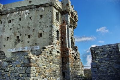
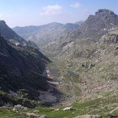
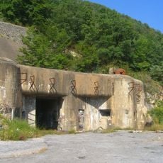
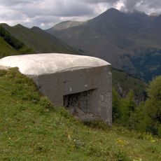
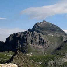
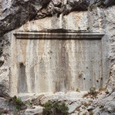
Redoute des Trois Communes is a military fort located at 2080 meters on the Authion massif, built with reinforced concrete between 1897 and 1899. The structure sits strategically in this alpine mountain landscape and stands out as a substantial fortification in the region.
The fort was built in the late 19th century as part of France's modern defensive strategy for the mountain region. During World War II, German forces occupied it until French troops retook the position in April 1945.
The fort represents a significant example of the Séré de Rivières military architecture system, showcasing how French defensive structures evolved in the late 19th century. This design demonstrates the transition from traditional to modern defensive thinking.
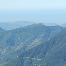
The fort itself remains closed to visitors, but hiking trails around the site offer views of the structure from a distance. The high elevation means weather can change quickly, so bring appropriate clothing for alpine conditions.
This fortification was among the first military structures in France built entirely from reinforced concrete, introducing modern construction methods to defensive architecture. This technical innovation was remarkable in Europe at the time of its construction and influenced future fort designs.
Location: Saorge
GPS coordinates: 44.00111,7.43306
Latest update: December 14, 2025 14:23
Vallée des Merveilles
8.4 km
Mont Bégo
8.1 km
Chapelle Notre-Dame de la Ménour
9 km
Monastère de Saorge
9.9 km
Cime du Diable
5.4 km
Ouvrage Flaut
8.2 km
Écomusée du haut-pays et des transports
9.1 km
Chapelle Notre-Dame-des-Grâces de Breil-sur-Roya
8.6 km
Ouvrage Plan Caval
904 m
Église de la Madone del Poggio
9.8 km
Église Saint-Sauveur de Saorge
9.6 km
Church Sancta-Maria-in-Albis
9.6 km
Grand Capelet
8.6 km
Chapelle Notre-Dame-des-Monts
8.9 km
Cime de Peïra-Cava
8.5 km
Porte d'Italie
9.8 km
Chapelle Saint-Antoine-l'Ermite de Breil-sur-Roya
9.8 km
Église Notre-Dame-de-la-Visitation
9.7 km
Chapelle Sainte-Catherine de Breil-sur-Roya
9.8 km
Chapelle Saint-Jacques des Pénitents blancs de Saorge
9.6 km
Chapelle des Pénitents rouges
9.6 km
Clocher Saint-Jean de Breil-sur-Roya
9.1 km
Petroglyphs in the Valley of Marvels
8.4 km
Église Saint-Bernard de Moulinet
6.8 km
Chapelle Saint-Roch de Saorge
9.4 km
Chapelle Saint-Grat de Belvédère
7.4 km
Chapelle de la Miséricorde des Pénitents noirs de Breil-sur-Roya
9.6 km
Plaques commémoratives de Saorge
9.2 kmVisited this place? Tap the stars to rate it and share your experience / photos with the community! Try now! You can cancel it anytime.
Discover hidden gems everywhere you go!
From secret cafés to breathtaking viewpoints, skip the crowded tourist spots and find places that match your style. Our app makes it easy with voice search, smart filtering, route optimization, and insider tips from travelers worldwide. Download now for the complete mobile experience.
A unique approach to discovering new places❞
— Le Figaro
All the places worth exploring❞
— France Info
A tailor-made excursion in just a few clicks❞
— 20 Minutes