
Guéckédou Prefecture, prefecture of Guinea
Location: Nzérékoré Region
Shares border with: Kissidougou Prefecture, Macenta Prefecture
GPS coordinates: 8.56667,-10.13330
Latest update: March 14, 2025 04:58
Mount Richard-Molard
217.2 km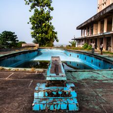
Ducor Hotel
261.1 km
Mount Nimba Strict Nature Reserve
220 km
Loma Mansa
130.7 km
Mount Wuteve
52.1 km
National Park of Upper Niger
215.3 km
Outamba-Kilimi National Park
247.5 km
Gola National Park
146.8 km
Tiwai Island
172.7 km
Sacred Heart Cathedral, Monrovia
261.1 km
Lofa-Mano National Park
90.9 km
Gabriel Tucker Bridge
260.8 km
Pinselly Classified Forest
243.8 km
Centennial Pavilion
206.2 km
Musée du Camp Soundiata Keita
220.6 km
Kenema Town Field
138.9 km
OAU Memorial Place
206.2 km
Zolu-Duma bridge
252.2 km
Saint Paul Bridge
252.2 km
Cape Mesurado Lighthouse
261 km
Ducor Intercontinental Hotel
261.1 km
Tubman Center of African Culture
244.4 km
Cece Beach
252.3 km
Kpatawee Waterfall
169.7 km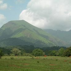
Mount Richard-Molard
216.7 km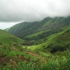
Reserva Natural Integral del Monte Nimba
215.4 km
Wulki Farm
246.5 km
Waterside Market
260.7 kmReviews
Visited this place? Tap the stars to rate it and share your experience / photos with the community! Try now! You can cancel it anytime.
Discover hidden gems everywhere you go!
From secret cafés to breathtaking viewpoints, skip the crowded tourist spots and find places that match your style. Our app makes it easy with voice search, smart filtering, route optimization, and insider tips from travelers worldwide. Download now for the complete mobile experience.

A unique approach to discovering new places❞
— Le Figaro
All the places worth exploring❞
— France Info
A tailor-made excursion in just a few clicks❞
— 20 Minutes