National Park of Upper Niger, National park in Kankan Prefecture, Guinea.
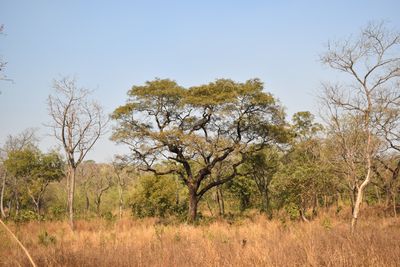
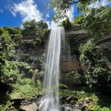
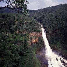
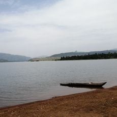
The National Park of Upper Niger stretches across woodland, bushland, and forest areas along the Niger and Mafou Rivers. The land is divided into a core protection zone for wildlife and a surrounding buffer zone where people carry out approved activities.
This area received protection in 1952 and became a national park in 1997. The designation helped safeguard one of Guinea's last dry forest sections from further loss.
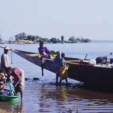
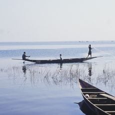
People living in the buffer zone carry on traditional ways of using the forest, growing crops and collecting forest products as part of their daily lives. These practices shape how the landscape looks and how communities relate to the natural surroundings.
The park is best accessed from the town of Kankan, and visitors should expect rough conditions, especially during the rainy season. A local guide is helpful for exploring both zones and improving chances of seeing wildlife.
Lions returned to the park after 1997, migrating from the Tinkisso River region and establishing it as a key conservation site for these big cats. Today, visitors have the chance to witness the presence of these animals in a place where they had disappeared.
Location: Kankan Prefecture
Inception: 1997
Address: 7WJ9+QPJ, Bora, Guinea
Phone: +224621288524
GPS coordinates: 10.50000,-10.20000
Latest update: December 6, 2025 17:43
Guinea is home to natural sites such as Mount Nimba, the Haut Niger Park, and the Los Islands. Religious buildings include the Grand Mosque of Conakry and the Sainte-Marie Cathedral. The country has several waterfalls, including Voile de la Mariée and Kambadaga. National museums present Guinean history and culture. Traditional markets and Atlantic beaches complete the tourism offerings.
Loma Mansa
173.7 km
Mount Wuteve
263.8 km
Sélingué Dam
249.8 km
Télimélé
313.1 km
Outamba-Kilimi National Park
215.9 km
Lake Sélingué
248.2 km
National Library of Mali
336.3 km
Dindefelo Falls
311.2 km
Lofa-Mano National Park
303 km
Mine de Siguiri
149.7 km
Pinselly Classified Forest
165.3 km
Lake Manantali
296.3 km
Stade Régional Saifoullaye Diallo
243.7 km
Kamablon of Kangaba
252.9 km
Kambadaga Falls
256.8 km
Forêt de Dalaba
224.2 km
Kouratier
227 km
Musée du Camp Soundiata Keita
98.3 km
Kenema Town Field
311.4 km
Chute de Ditinn
220.1 km
Cascade de Tabouna
290.8 km
Abdoul Karim Camara
335 km
Arch of Kamandjan
293.8 km
Villa de Dalaba
226.9 km
Case à palabres de Dalaba
226.9 km
Cascade du Voile de la Mariée
290.2 km
Chuttes de Sala
268.5 km
Lac de Samaya
311.3 kmReviews
Visited this place? Tap the stars to rate it and share your experience / photos with the community! Try now! You can cancel it anytime.
Discover hidden gems everywhere you go!
From secret cafés to breathtaking viewpoints, skip the crowded tourist spots and find places that match your style. Our app makes it easy with voice search, smart filtering, route optimization, and insider tips from travelers worldwide. Download now for the complete mobile experience.
A unique approach to discovering new places❞
— Le Figaro
All the places worth exploring❞
— France Info
A tailor-made excursion in just a few clicks❞
— 20 Minutes