Chest opened
+${chestReward.xp} XP
Explorer
NOUVEAU ×${chestReward.collectible.quantity}
tapez pour fermer

See the monuments around you in AR Open chests in the app

Around Us is built for your phone — point your camera at the streets and discover the monuments and places around you in augmented reality. Around Us is built for your phone — chests unlock when you walk, explore and capture nearby places.

•

Enable Location

We need your location to show you interesting places around you

Discover nearby places

Find interesting locations and hidden gems around you

Precise directions

Get accurate directions and distances to places

Your location is never shared with other users. It's only used when you tap the location button.

Tanjung Bara

Log in to your account

Start exploring — it's free

Trusted by 92,634 travelers worldwide

Continue with Google
Continue with Apple
or

We will send you a code to connect

By continuing, you accept our Terms and Conditions and our Privacy Policy

Check your inbox

We've sent a pincode in your inbox. Please enter the code below.

Tanjung Bara

Tanjung Bara, Coal loading port in East Kalimantan, Indonesia

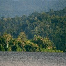
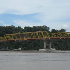
Tanjung Bara is a coal export terminal on the coast of East Kalimantan, connected to the mining areas around Sangatta. The facility has loading infrastructure and docking areas built to handle large cargo vessels.

Tanjung Bara Coal Terminal began operating in 1991, built to ship coal from the Sangatta mine about 20 km to the southwest. It is owned and operated by Kaltim Prima Coal, a joint venture of BP and Rio Tinto. Together with Taboneo near Banjarmasin, it became one of Indonesia's largest coal loading ports.

The terminal is owned and operated by Kaltim Prima Coal, a joint venture of BP and Rio Tinto. Together with Taboneo near Banjarmasin, Tanjung Bara ranks among Indonesia's largest coal loading ports, and the two names are commonly paired in the country's coal export trade.

Tanjung Bara is an operating coal terminal owned by Kaltim Prima Coal, so there is no public access to the wharves. Ships are met by pilots about 7 miles (11 km) offshore, and the terminal runs around the clock. The nearest town is Sangatta, roughly 20 km southwest; Bontang is the closest city. Tidal range is 2.8 to 4.4 m.

The channel in front of the terminal is deep enough to receive cape-sized vessels year-round, some of the largest cargo ships in the world. These ships are too wide to pass through the Panama or Suez canals and must sail around Cape Horn or the Cape of Good Hope instead.

The community of curious travelers

AroundUs brings together thousands of curated places, local tips, and hidden gems, enriched daily by 92,634 contributors worldwide.

Start exploring
GPS coordinates
0.58602,117.70371
Latest update
October 24, 2026 13:11
Reviews
Share your experience

No review yet

Discussions
Start a discussion...

No discussion yet

« Tanjung Bara - Coal loading port in East Kalimantan, Indonesia » is provided by Around Us (aroundus.com). Images and texts are derived from Wikimedia project under a Creative Commons license. You are allowed to copy, distribute, and modify copies of this page, under the conditions set by the license, as long as this note is clearly visible.

Discover hidden gems everywhere you go!

From secret cafés to breathtaking viewpoints, skip the crowded tourist spots and find places that match your style. Our app makes it easy with voice search, smart filtering, route optimization, and insider tips from travelers worldwide. Download now for the complete mobile experience.
Around Us App Screenshot
❝

A unique approach to discovering new places❞

— Le Figaro

❝

All the places worth exploring❞

— France Info

❝

A tailor-made excursion in just a few clicks❞

— 20 Minutes

Around Us
Travel Guide & Maps
Download

Send to your phone

QR Code
1

Open the camera app on your mobile.

2

Point at the QR code with your camera. A notification will appear.

3

Tap the notification to open the link.