Enable Location

We need your location to show you interesting places around you

Discover nearby places

Find interesting locations and hidden gems around you

Precise directions

Get accurate directions and distances to places

Your location is never shared with other users. It's only used when you tap the location button.

Baurtregaum

Log in to your account

Start exploring — it's free

Trusted by 63,123 travelers worldwide

Continue with Google
Continue with Apple
or

We will send you a code to connect

By continuing, you accept our Terms and Conditions and our Privacy Policy

Check your inbox

We've sent a pincode in your inbox. Please enter the code below.

Baurtregaum
Discussion Reviews 1 Photos
2.6k Popularity

Baurtregaum, Mountain summit in County Kerry, Ireland

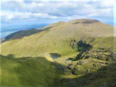
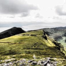
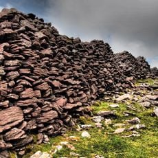
Baurtregaum is a mountain in the Slieve Mish range on the Dingle Peninsula, rising 851 meters above sea level. Its rocky ridges and steep slopes are carved by three valleys that run through the landscape, creating a stark and layered terrain.

The name comes from Irish Barr Trí gCom, meaning three valleys, referring to the trio of glacial formations that shape the mountain. These valleys were carved during the ice age and remain the defining feature of the landscape today.

The mountain holds the rank of 13th highest peak in Ireland according to the Arderin scale and 18th highest on the Vandeleur-Lynam classification.

Several hiking trails lead to the summit, including the Derrymore Glen Horseshoe, an 11-kilometer loop that passes through adjacent peaks. Routes require reasonable fitness and proper gear, especially given the changeable mountain weather of the region.

The three valleys flow from a single mountain mass and each contains rivers running from the summit slopes. This arrangement of water-carved formations creates an unusual glacial pattern that becomes visible as you climb higher.

The community of curious travelers

AroundUs brings together thousands of curated places, local tips, and hidden gems, enriched daily by 60,000 contributors worldwide.

Start exploring
Location
Elevation above the sea
851 m
GPS coordinates
52.20706,-9.82950
Latest update
December 12, 2025 17:46
Reviews
Share your experience

No review yet

Discussions
Start a discussion...

No discussion yet

« Baurtregaum - Mountain summit in County Kerry, Ireland » is provided by Around Us (aroundus.com). Images and texts are derived from Wikimedia project under a Creative Commons license. You are allowed to copy, distribute, and modify copies of this page, under the conditions set by the license, as long as this note is clearly visible.

Discover hidden gems everywhere you go!

From secret cafés to breathtaking viewpoints, skip the crowded tourist spots and find places that match your style. Our app makes it easy with voice search, smart filtering, route optimization, and insider tips from travelers worldwide. Download now for the complete mobile experience.

Around Us App Screenshot

A unique approach to discovering new places

Le Figaro

All the places worth exploring

France Info

A tailor-made excursion in just a few clicks

20 Minutes

Around Us
Travel Guide & Maps
Download

Send to your phone

QR Code
1

Open the camera app on your mobile.

2

Point at the QR code with your camera. A notification will appear.

3

Tap the notification to open the link.