Kurnool district, Administrative district in Andhra Pradesh, India.
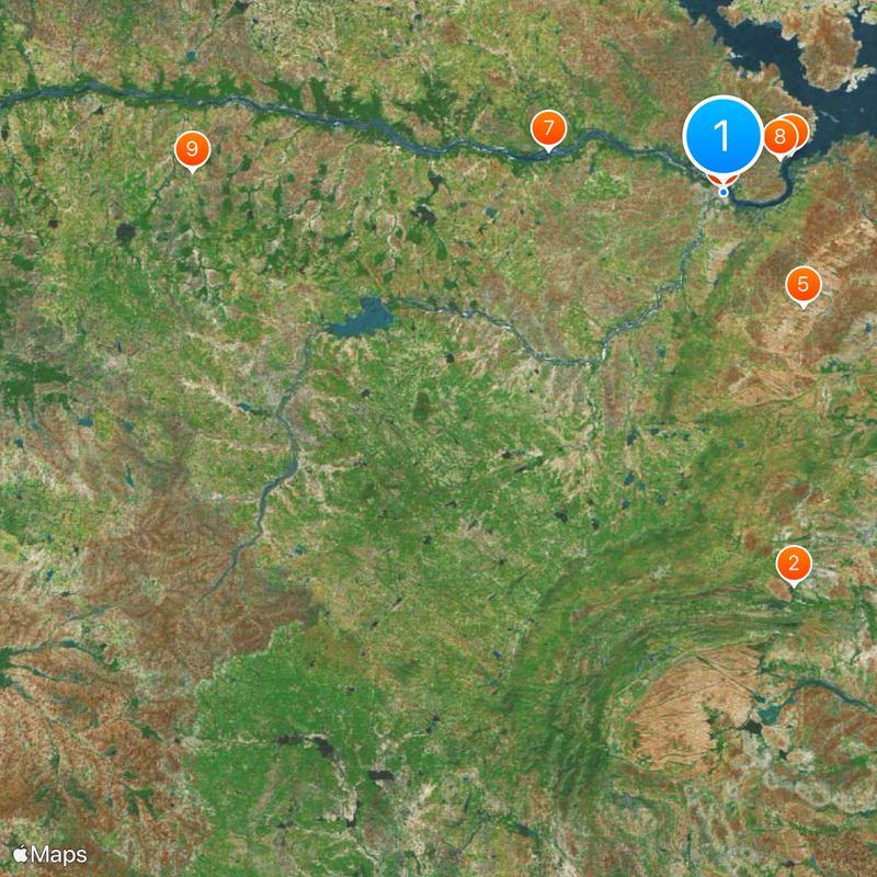
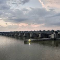
Kurnool is a district in Andhra Pradesh, located inland in the southern part of the state, with portions of its territory following the path of the Tungabhadra River. The terrain alternates between hills, river basins and dry agricultural plains that spread across wide expanses.
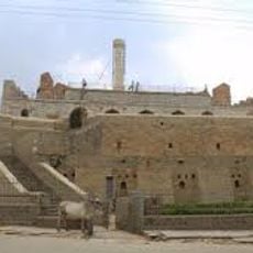
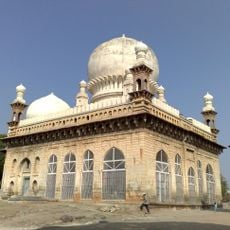
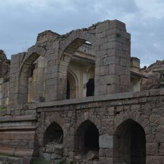
The area was under the rule of different dynasties for centuries, including the Chalukyas and later the Vijayanagara kingdom during medieval times. The district was formally organized during British colonial rule in the 19th century and became part of Andhra Pradesh after independence.
The district maintains traditional festivals throughout the year, with local communities celebrating Makar Sankranti, Ugadi, and regional harvest ceremonies with music and dance.
The district is accessible via highways and railway lines, with the main town of Kurnool serving as a hub for travelers passing through. The dry months between October and March offer more comfortable conditions for visiting, as temperatures rise very high during summer.
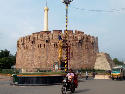
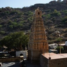
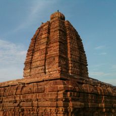
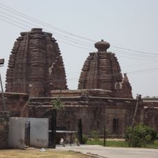
The region holds several ancient temples and cave formations that visitors often overlook because they lie off the main routes. These sites offer insights into religious practices and stonework from past centuries.
Location: Andhra Pradesh
Capital city: Kurnool
Shares border with: Raichur district, YSR district, Anantapuramu district
Website: https://kurnool.ap.gov.in
GPS coordinates: 15.83000,78.05000
Latest update: December 4, 2025 23:42
Belum Caves
81.3 km
Yaganti Temple
54.2 km
Alampur Jogulamba Temple
10.2 km
Konda Reddy Fort
442 m
Chowdeshwari Temple at Nandavaram
56.5 km
Bellary Fort
143.9 km
Orvakal Rock Garden, Kurnool
18.9 km
K. C. Canal
24.4 km
Bugga Ramalingeswara temple
101.6 km
Daroji Sloth Bear Sanctuary
177.4 km
Gooty Fort
90.5 km
Alampur Navabrahma Temples
10.6 km
Galeru Nagari Sujala Sravanthi Project
115.8 km
Raichur Fort
83.6 km
Chintala Venkataramana Temple, Tadipatri
102.4 km
Sunkesula Barrage
24.4 km
Alampur Papanasi Temples
9 km
Mounagiri Hanuman Temple
159.6 km
Anantapur clock tower
136.9 km
Aqua Fun
150.5 km
Abdul Wahab Khan's Tomb
472 m
Sri Lakshmi Narasimha Swamy Temple, Ahobilam
102.4 km
Yaganti Caves
54.2 km
Adoni Fort
85.4 km
Gandikota Fort
116 km
Vitthala Temple, Hampi
177.3 km
Vijaya Vithala temple
177.4 km
Vishnu Temple No.III facing South Gateway of Vittala Temple
177.4 kmVisited this place? Tap the stars to rate it and share your experience / photos with the community! Try now! You can cancel it anytime.
Adoni mandal
Yemmiganur mandal
Kallur mandal
Kodumur mandal
Orvakal mandal
Aspari mandal
Alur mandal
Krishnagiri mandal
Kowthalam mandal
Kosigi mandal
Holagunda mandal
Halaharvi mandal
Veldurthi mandal
Maddikera (East) mandal
Mantralayam mandal
Pedda Kadubur mandal
Pattikonda mandal
Nandavaram mandal
Devanakonda mandal
Tuggali mandal
C.Belagal mandal
Chippagiri mandal
Gonegandla mandal
Gudur mandal
Discover hidden gems everywhere you go!
From secret cafés to breathtaking viewpoints, skip the crowded tourist spots and find places that match your style. Our app makes it easy with voice search, smart filtering, route optimization, and insider tips from travelers worldwide. Download now for the complete mobile experience.
A unique approach to discovering new places❞
— Le Figaro
All the places worth exploring❞
— France Info
A tailor-made excursion in just a few clicks❞
— 20 Minutes