Enable Location

We need your location to show you interesting places around you

Discover nearby places

Find interesting locations and hidden gems around you

Precise directions

Get accurate directions and distances to places

Your location is never shared with other users. It's only used when you tap the location button.

Barpeta district

Log in to your account

Start exploring — it's free

Trusted by 61,865 travelers worldwide

Continue with Google
Continue with Apple
or

We will send you a code to connect

By continuing, you accept our Terms and Conditions and our Privacy Policy

Check your inbox

We've sent a pincode in your inbox. Please enter the code below.

Barpeta district

Barpeta district, Administrative district in Lower Assam division, India

Description

Barpeta district is an administrative region in Lower Assam that encompasses rural villages, urban centers, and productive farmland across its territory. The area contains a mix of residential communities and agricultural zones that form the backbone of local life.

History

The district was established as a separate administrative entity in 1983 when it was separated from the neighboring Kamrup district. This division created an independent region to manage its own local affairs and development.

Culture

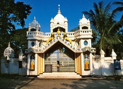
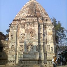
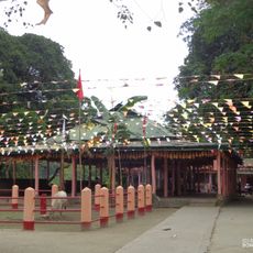
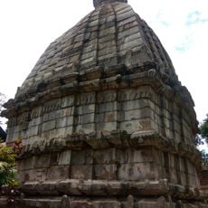
The Barpeta Satra, a spiritual monastery, serves as a major pilgrimage site where visitors experience devotional practices and local worship traditions. The site draws people throughout the year, especially during festivals that bring the community together.

Practical

The district has a network of schools and healthcare facilities distributed across its communities. Medical services and educational institutions are located throughout the region to serve residents and visitors alike.

Did you know?

The region is known for its rice cultivation traditions that have shaped farming practices for generations. The fields and harvesting methods reflect a way of life deeply connected to the agricultural cycle.

Inception
1983
Capital city
Barpeta
Shares border with
Chirang district
GPS coordinates
26.53333,91.00000
Latest update
December 20, 2025 15:40

AroundUs brings together thousands of curated places, local tips, and hidden gems, enriched daily by 60,000 contributors worldwide. Discover all places nearby (Lower Assam division).

« Barpeta district - Administrative district in Lower Assam division, India » is provided by Around Us (aroundus.com). Images and texts are derived from Wikimedia project under a Creative Commons license. You are allowed to copy, distribute, and modify copies of this page, under the conditions set by the license, as long as this note is clearly visible.

Discover hidden gems everywhere you go!

From secret cafés to breathtaking viewpoints, skip the crowded tourist spots and find places that match your style. Our app makes it easy with voice search, smart filtering, route optimization, and insider tips from travelers worldwide. Download now for the complete mobile experience.

Around Us App Screenshot

A unique approach to discovering new places

Le Figaro

All the places worth exploring

France Info

A tailor-made excursion in just a few clicks

20 Minutes

Around Us
Travel Guide & Maps
Download

Send to your phone

QR Code
1

Open the camera app on your mobile.

2

Point at the QR code with your camera. A notification will appear.

3

Tap the notification to open the link.