Goalpara district, Administrative district in Lower Assam division, India
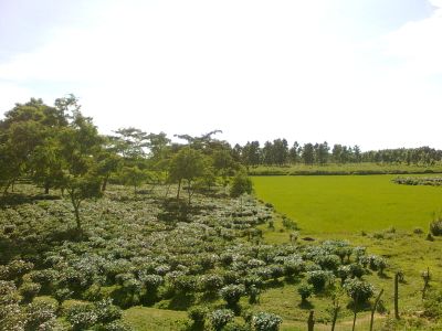
Goalpara is an administrative district in Lower Assam covering roughly 1,800 square kilometers across eastern India. The region is shaped by rivers and agricultural lands where rice, jute, and sugarcane grow on farms throughout the area.
The district came under British control in 1765 and underwent administrative changes over time. In 1874, the headquarters relocated to Dhubri, marking a significant shift in how the region was managed.
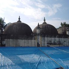
People speak multiple languages in daily life, including Assamese, Bengali, and Garo, reflecting the region's diversity. Religious sites from different faiths stand throughout the area, showing how communities have long coexisted here.
Visitors should prepare for warm and humid weather, especially during the monsoon season when roads can flood. The best time to explore is during drier months when paths are easier to walk and the landscape looks greener.
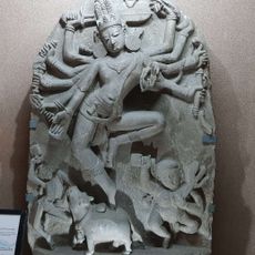
The Sri Surya Pahar archaeological site holds structures from multiple faiths in one location, showing how different believers lived together for centuries. The Pir Majhar shrine is visited today by people from different religions, continuing this tradition of shared respect.
Location: Lower Assam division
Inception: October 20, 1994
Capital city: Goalpara
Shares border with: Bongaigaon district
Website: http://goalpara.gov.in
GPS coordinates: 26.43333,90.36667
Latest update: December 22, 2025 18:57
Manas National Park
64.6 kmNokrek National Park
103.3 km
Balpakram National Park
110.8 kmDhubri-Phulbari bridge
60.7 km
Naranarayan Setu
31.6 km
Sri Surya Pahar
49.7 kmChakrashila Wildlife Sanctuary
11.3 km
Panbari Mosque
43.9 kmDhamrai Jagannath Roth
59.4 kmKakoijana Reserved Forest
65.2 kmUltapani Reserve Forest
31 kmBileswar Temple
98.5 kmSiju Wildlife Sanctuary
126.1 kmTukreswari Temple
50.3 km
Ambari Archeological Site
113.9 kmRangamati Idgah
46.4 kmShankarghola Forest Reserve
21.6 kmNokrek
105.6 kmNasep pool
118.1 kmJyoti Prasad Agarwala Statue
60.3 kmNetaji Subash Chandra Bose Statue
60.6 kmPhool Kumari Kalita Statue
60.4 kmSUBHASH CH BOSE
34.8 kmScenic viewpoint
67.1 kmScenic viewpoint
83.1 kmWatch tower
71.5 kmMatcha Nokpante
108.9 kmHighest point of Garo hills. metal tower
108.2 kmVisited this place? Tap the stars to rate it and share your experience / photos with the community! Try now! You can cancel it anytime.
Discover hidden gems everywhere you go!
From secret cafés to breathtaking viewpoints, skip the crowded tourist spots and find places that match your style. Our app makes it easy with voice search, smart filtering, route optimization, and insider tips from travelers worldwide. Download now for the complete mobile experience.
A unique approach to discovering new places❞
— Le Figaro
All the places worth exploring❞
— France Info
A tailor-made excursion in just a few clicks❞
— 20 Minutes