Enable Location

We need your location to show you interesting places around you

Discover nearby places

Find interesting locations and hidden gems around you

Precise directions

Get accurate directions and distances to places

Your location is never shared with other users. It's only used when you tap the location button.

Log in to your account

Start exploring — it's free

Trusted by 61,503 travelers worldwide

Continue with Google
Continue with Apple
or

We will send you a code to connect

By continuing, you accept our Terms and Conditions and our Privacy Policy

Check your inbox

We've sent a pincode in your inbox. Please enter the code below.

Sonitpur district

Sonitpur district, Administrative district in North Assam, India

Description

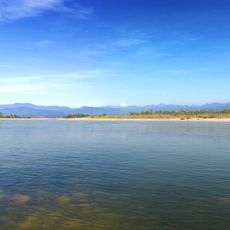
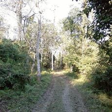
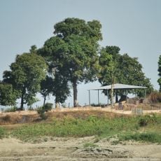
Sonitpur is an administrative district in North Assam that spreads across flat land between the Himalayan foothills and the Brahmaputra Valley. Several rivers flow through the region, providing water for farming and supporting settlements throughout the area.

History

The district's name comes from ancient Hindu texts that describe the region as an important place in old stories. Over the centuries, it grew from a legendary center into an administrative area shaped by regional developments.

Culture

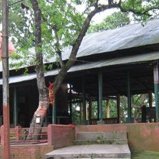
Multiple communities live here with their own religious traditions and festivals that shape local life. These celebrations bring people together and are visible in the way neighborhoods gather for seasonal observances.

Practical

The best time to visit is from October to April when the weather is mild and dry. During the monsoon season from May to September, it becomes hot and wet, so travelers should plan accordingly.

Did you know?

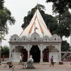
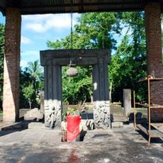
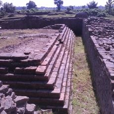
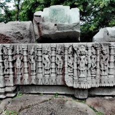
Ancient temple ruins from the early Gupta period can be found around Tezpur, showing rare examples of early architecture. These structures give visitors a glimpse into the craftsmanship and artistic styles of that time.

Location
North Assam division
Capital city
Tezpur
Elevation above the sea
48 m
Shares border with
East Kameng district, Golaghat district, Nagaon district
GPS coordinates
26.63000,92.80000
Latest update
December 20, 2025 12:12

AroundUs brings together thousands of curated places, local tips, and hidden gems, enriched daily by 60,000 contributors worldwide. Discover all places nearby (North Assam division).

« Sonitpur district - Administrative district in North Assam, India » is provided by Around Us (aroundus.com). Images and texts are derived from Wikimedia project under a Creative Commons license. You are allowed to copy, distribute, and modify copies of this page, under the conditions set by the license, as long as this note is clearly visible.

Discover hidden gems everywhere you go!

From secret cafés to breathtaking viewpoints, skip the crowded tourist spots and find places that match your style. Our app makes it easy with voice search, smart filtering, route optimization, and insider tips from travelers worldwide. Download now for the complete mobile experience.

Around Us App Screenshot

A unique approach to discovering new places

Le Figaro

All the places worth exploring

France Info

A tailor-made excursion in just a few clicks

20 Minutes

Around Us
Travel Guide & Maps
Download

Send to your phone

QR Code
1

Open the camera app on your mobile.

2

Point at the QR code with your camera. A notification will appear.

3

Tap the notification to open the link.