Satpura Range, Mountain range in central India
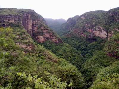
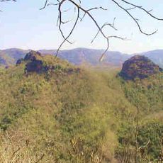
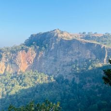
The Satpura Range is a forested mountain system in central India stretching through Maharashtra, Madhya Pradesh, Gujarat, and Chhattisgarh. The ridges rise to around 1,350 meters (4,400 feet) above sea level and form a continuous landmass with deep valleys and isolated plateaus.
The mountain system formed a natural boundary between northern and southern regions of India for centuries. Trade routes followed its lower passes, linking the river valleys on either side.
Indigenous Gond tribes maintain their traditional practices in the hills, utilizing rotational field cultivation methods to sustain their agricultural communities.
Several national parks lie within the mountain system and offer access to walking trails and viewpoints. The cooler, drier months are the best time to visit, when the paths are more accessible.
The area separates the watersheds of the Narmada and Tapti rivers, which flow in opposite directions. Both rivers reach the Arabian Sea despite their different courses.
The community of curious travelers
AroundUs brings together thousands of curated places, local tips, and hidden gems, enriched daily by 60,000 contributors worldwide.