Enable Location

We need your location to show you interesting places around you

Discover nearby places

Find interesting locations and hidden gems around you

Precise directions

Get accurate directions and distances to places

Your location is never shared with other users. It's only used when you tap the location button.

Nandurbar district

Log in to your account

Start exploring — it's free

Trusted by 61,665 travelers worldwide

Continue with Google
Continue with Apple
or

We will send you a code to connect

By continuing, you accept our Terms and Conditions and our Privacy Policy

Check your inbox

We've sent a pincode in your inbox. Please enter the code below.

Nandurbar district

Nandurbar district, Administrative district in Maharashtra, India

Description

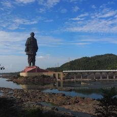
Nandurbar district is an administrative area in northwestern Maharashtra with varied terrain including rivers, hills, and cultivated fields spread across its landscape. The region is connected by a railway line and an extensive network of roads that link towns and villages throughout the territory.

History

The district was created in 1998 when it separated from Dhule district, making it a relatively recent administrative division. The area was formerly part of the ancient Satpuda Pradesh region, a past that continues to shape its geography and settlements.

Culture

The Bhil communities here maintain their own languages and celebration practices that shape how people in villages interact and gather together.

Practical

The monsoon season brings green landscapes and more comfortable weather for visiting, making it the better time to explore the area. Sturdy footwear is recommended because many routes pass through rural areas and unpaved pathways.

Did you know?

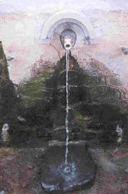
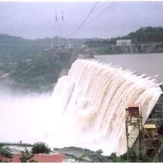
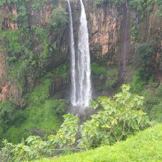
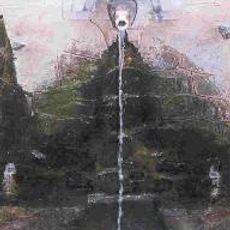
The district is known for river valleys that form impressive waterfalls during monsoon season, attracting hikers to remote areas. These natural formations appear because of the hilly terrain and heavy seasonal rainfall that transforms the landscape dramatically.

Location
Capital city
Nandurbar
Shares border with
Narmada district, Dhule district
GPS coordinates
21.22800,74.14220
Latest update
December 17, 2025 10:24

AroundUs brings together thousands of curated places, local tips, and hidden gems, enriched daily by 60,000 contributors worldwide. Discover all places nearby (Nashik division).

« Nandurbar district - Administrative district in Maharashtra, India » is provided by Around Us (aroundus.com). Images and texts are derived from Wikimedia project under a Creative Commons license. You are allowed to copy, distribute, and modify copies of this page, under the conditions set by the license, as long as this note is clearly visible.

Discover hidden gems everywhere you go!

From secret cafés to breathtaking viewpoints, skip the crowded tourist spots and find places that match your style. Our app makes it easy with voice search, smart filtering, route optimization, and insider tips from travelers worldwide. Download now for the complete mobile experience.

Around Us App Screenshot

A unique approach to discovering new places

Le Figaro

All the places worth exploring

France Info

A tailor-made excursion in just a few clicks

20 Minutes

Around Us
Travel Guide & Maps
Download

Send to your phone

QR Code
1

Open the camera app on your mobile.

2

Point at the QR code with your camera. A notification will appear.

3

Tap the notification to open the link.