Gazole community development block, Administrative block in Malda Sadar subdivision, India
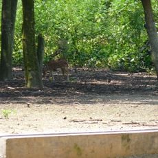
Gazole is an administrative block located within the Barind region, featuring ancient alluvial terrain and natural ridges that protect it from seasonal flooding. The landscape combines these elevated formations with fertile plains suitable for farming and settlement.
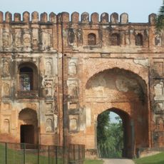
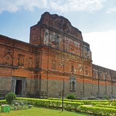
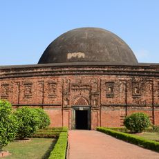
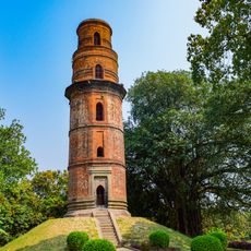
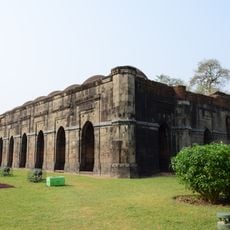
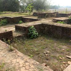
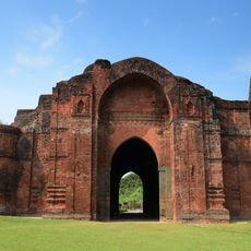
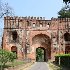
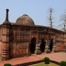
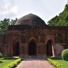
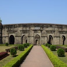
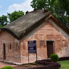
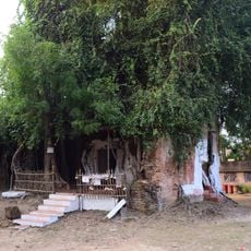
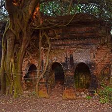
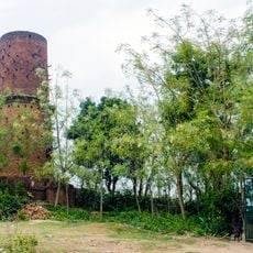
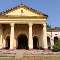
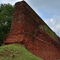
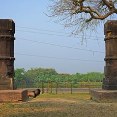
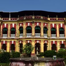
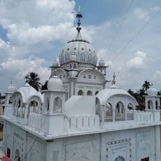
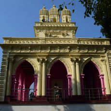
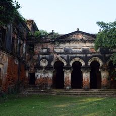
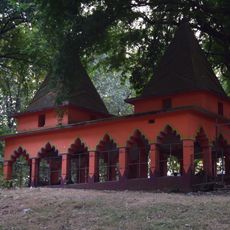
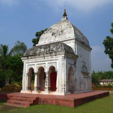
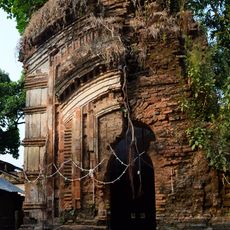
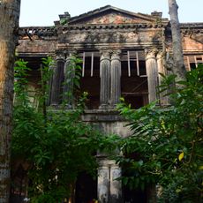
The territory served as a major political center during the Sena Dynasty and later under the Hussain Shahi sultans. Ruins of Pandua within the block remain evidence of its historical role as a seat of power.
Bengali, Santali, and Koda speakers coexist in the region, reflecting the linguistic diversity of the area. Hindu and Muslim communities share daily life and local traditions throughout the block.
The block has schools, healthcare facilities including rural hospitals, and electricity reaching inhabited settlements. Visitors should prepare for rural conditions and allow time for travel within the spread-out area.
The block receives government funding through a special scheme designed to support development in economically backward regions. This targeted financial assistance enables community projects and infrastructure improvements.
Location: Malda Sadar subdivision
Shares border with: Chanchal II community development block, Ratua II community development block, Old Malda community development block, Habibpur community development block, Bamangola community development block, Itahar community development block, Harirampur community development block, Bansihari community development block
GPS coordinates: 25.22048,88.18927
Latest update: December 10, 2025 16:21
Gauḍa
38.1 km
Adina Mosque
8 km
Pandua
10.5 km
Eklakhi Mausoleum
9.8 km
Firoz Minar
39.1 km
Baro Shona Masjid
38.1 km
Jagjivanpur
27.4 km
Adina Deer Park
9.1 km
Dakhil Darwaza
38.6 km
Lukachuri Gateway
39.6 km
Qadam Rasul Mosque
39.5 km
Chamkati Masjid
39.4 km
Qutub Shahi Masjid
9.8 km
Tomb of Fateh Khan
39.6 km
Mandirbasini temple
30.9 km
Poragachhi temple
33.5 km
Tower of Nimasarai
21 km
Durgadalan of Bhupalpur Rajbari
35.6 km
Baisgazi Wall
39.4 km
Two stone pillars
35.1 km
Bhupalpur Rajbari
35.6 km
Gurdwara Nima Serai Sri Guru Tegh Bahadur
20.2 km
Pramatheshwar Mahadevjiu temple
16 km
Thakurdalan of Zamindar house of Bandopadhyay family
35.4 km
Bhaior Mata temple
28.5 km
Panchamukhi Shiva Temple
33.1 km
Kardaha Shiva temple
30.8 km
Zamindar house of Bandopadhyay family
35.5 kmVisited this place? Tap the stars to rate it and share your experience / photos with the community! Try now! You can cancel it anytime.
Discover hidden gems everywhere you go!
From secret cafés to breathtaking viewpoints, skip the crowded tourist spots and find places that match your style. Our app makes it easy with voice search, smart filtering, route optimization, and insider tips from travelers worldwide. Download now for the complete mobile experience.
A unique approach to discovering new places❞
— Le Figaro
All the places worth exploring❞
— France Info
A tailor-made excursion in just a few clicks❞
— 20 Minutes